Area Overview for LN1 1DP
Photos of LN1 1DP
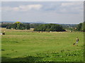
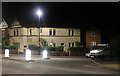
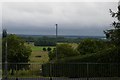
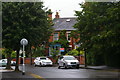
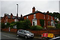
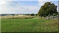
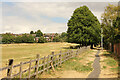
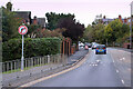
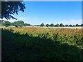
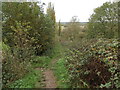

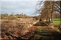
30 photos from this area
Area Information
Key information about the LN1 1DP including its size, population, and administrative classification.
- Area Type
- Postcode
- Area Size
- 3.6 hectares
- Population
- 2486
- Population Density
- 725 people/km²
House Prices in LN1 1DP
15
Properties
£244,722
Average Sold Price
£109,000
Lowest Price
£402,000
Highest Price
Showing 15 properties
| Address | Type | Beds | Baths | Last Sale Price | Last Sale Date | |
|---|---|---|---|---|---|---|
| 35 Long Leys Road, Lincoln, LN1 1DP | Detached | 4 | 1 | £402,000 | Nov 2024 | |
| 40 Long Leys Road, Lincoln, LN1 1DP | Bungalow | 3 | 2 | £368,000 | Apr 2024 | |
| 32 Long Leys Road, Lincoln, LN1 1DP | Detached | 4 | 2 | £167,500 | Sep 2021 | |
| 37 Long Leys Road, Lincoln, LN1 1DP | house | - | - | £390,000 | Jun 2019 | |
| 33 Long Leys Road, Lincoln, LN1 1DP | house | - | 1 | £275,000 | May 2019 | |
| 44 Long Leys Road, Lincoln, LN1 1DP | Bungalow | - | - | £180,000 | Nov 2016 | |
| 42 Long Leys Road, Lincoln, LN1 1DP | Bungalow | 3 | - | £175,000 | Oct 2011 | |
| 43 Long Leys Road, Lincoln, LN1 1DP | Detached | - | - | £135,995 | Nov 2005 | |
| 36 Long Leys Road, Lincoln, LN1 1DP | Detached | - | - | £109,000 | Oct 2000 | |
| 34 Long Leys Road, Lincoln, LN1 1DP | Detached | - | - | - | - |
Page 1 of 2
Energy Efficiency in LN1 1DP
Amenities
Schools
| Rank | School | Type | Entry gender | Ages |
|---|
Explore more schools in this area
Go to Schools tabDemographics
Household Size
Two person
most common
Accommodation Type
Houses
most common
Tenure
70
majority
Ethnic Group
White
most common
Religion
N/A
most common
Household Composition
N/A
most common
Age
47
median
Adults (30-64 years)
most common
Household Deprivation
N/A
with no deprivation
NS-SEC
45
in Lower managerial occupations
Explore more demographic insights in this area
Go to Demographics tabPlanning
Planning Constraints
- Flood RiskPremium
- Ramsar Wetland SitesPremium
- Area of Outstanding Natural BeautyPremium
- Protected Nature ReservePremium
- Protected WoodlandPremium