Area Overview for LN1 3NQ
Photos of LN1 3NQ
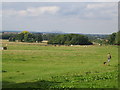
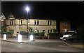
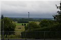
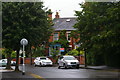
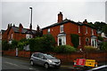
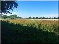
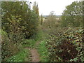
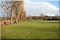
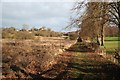
30 photos from this area
Area Information
Key information about the LN1 3NQ including its size, population, and administrative classification.
- Area Type
- Postcode
- Area Size
- 4.1 hectares
- Population
- 2486
- Population Density
- 725 people/km²
House Prices in LN1 3NQ
36
Properties
£244,434
Average Sold Price
£43,000
Lowest Price
£630,000
Highest Price
Showing 36 properties
| Address | Type | Beds | Baths | Last Sale Price | Last Sale Date | |
|---|---|---|---|---|---|---|
| 211 Yarborough Road, Lincoln, LN1 3NQ | house | 5 | 2 | £630,000 | May 2025 | |
| 140 Yarborough Road, Lincoln, LN1 3NQ | house | - | - | £300,000 | Feb 2022 | |
| 231 Yarborough Road, Lincoln, LN1 3NQ | Semi-detached | 3 | 1 | £340,000 | Jun 2021 | |
| 136 Yarborough Road, Lincoln, LN1 3NQ | Semi-detached | 4 | - | £445,000 | Nov 2020 | |
| 227 Yarborough Road, Lincoln, LN1 3NQ | Semi-detached | 4 | 2 | £267,000 | Mar 2020 | |
| 146 Yarborough Road, Lincoln, LN1 3NQ | Semi-detached | 3 | 1 | £242,000 | Sep 2019 | |
| 173 Yarborough Road, Lincoln, LN1 3NQ | Detached | 3 | 1 | £250,000 | May 2019 | |
| 199 Yarborough Road, Lincoln, LN1 3NQ | Detached | 4 | 1 | £240,000 | Nov 2017 | |
| 203 Yarborough Road, Lincoln, LN1 3NQ | Semi-detached | 1 | 1 | £526,000 | Jan 2016 | |
| 225 Yarborough Road, Lincoln, LN1 3NQ | Semi-detached | 4 | 2 | £279,950 | Jun 2014 |
Page 1 of 4
Energy Efficiency in LN1 3NQ
Amenities
Schools
| Rank | School | Type | Entry gender | Ages |
|---|
Explore more schools in this area
Go to Schools tabDemographics
Household Size
Two person
most common
Accommodation Type
Houses
most common
Tenure
70
majority
Ethnic Group
White
most common
Religion
N/A
most common
Household Composition
N/A
most common
Age
47
median
Adults (30-64 years)
most common
Household Deprivation
N/A
with no deprivation
NS-SEC
45
in Lower managerial occupations
Explore more demographic insights in this area
Go to Demographics tabPlanning
Planning Constraints
- Flood RiskPremium
- Ramsar Wetland SitesPremium
- Area of Outstanding Natural BeautyPremium
- Protected Nature ReservePremium
- Protected WoodlandPremium