Area Overview for LN1 1LR
Photos of LN1 1LR
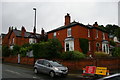
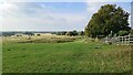
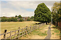
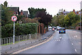
30 photos from this area
Area Information
Key information about the LN1 1LR including its size, population, and administrative classification.
- Area Type
- Postcode
- Area Size
- 1.4 hectares
- Population
- 1668
- Population Density
- 7153 people/km²
House Prices in LN1 1LR
25
Properties
£173,821
Average Sold Price
£13,650
Lowest Price
£295,000
Highest Price
Showing 25 properties
| Address | Type | Beds | Baths | Last Sale Price | Last Sale Date | |
|---|---|---|---|---|---|---|
| 15 Queens Crescent, Lincoln, LN1 1LR | Terraced | 2 | 1 | £235,000 | Jan 2025 | |
| 6 Queens Crescent, Lincoln, LN1 1LR | Terraced | 3 | 2 | £263,000 | May 2024 | |
| 11 Queens Crescent, Lincoln, LN1 1LR | Terraced | 3 | - | £190,000 | Dec 2020 | |
| 8 Queens Crescent, Lincoln, LN1 1LR | house | 3 | - | £235,000 | Dec 2019 | |
| 27 Queens Crescent, Lincoln, LN1 1LR | Semi-detached | 3 | 1 | £180,000 | Dec 2019 | |
| 7 Queens Crescent, Lincoln, LN1 1LR | house | - | - | £295,000 | Apr 2019 | |
| 14 Queens Crescent, Lincoln, LN1 1LR | Terraced | 6 | 3 | £282,500 | May 2016 | |
| 21 Queens Crescent, Lincoln, LN1 1LR | Semi-detached | 3 | 1 | £180,000 | Apr 2015 | |
| 4 Queens Crescent, Lincoln, LN1 1LR | Terraced | 2 | - | £174,950 | Oct 2014 | |
| 10 Queens Crescent, Lincoln, LN1 1LR | house | 3 | - | £164,000 | Aug 2014 |
Page 1 of 3
Energy Efficiency in LN1 1LR
Amenities
Schools
| Rank | School | Type | Entry gender | Ages |
|---|
Explore more schools in this area
Go to Schools tabDemographics
Household Size
One person
most common
Accommodation Type
Houses
most common
Tenure
54
majority
Ethnic Group
White
most common
Religion
N/A
most common
Household Composition
N/A
most common
Age
22
median
Young Adults (15-29 years)
most common
Household Deprivation
N/A
with no deprivation
NS-SEC
27
in Lower managerial occupations
Explore more demographic insights in this area
Go to Demographics tabPlanning
Planning Constraints
- Flood RiskPremium
- Ramsar Wetland SitesPremium
- Area of Outstanding Natural BeautyPremium
- Protected Nature ReservePremium
- Protected WoodlandPremium