Area Overview for West Lindsey District
Photos of West Lindsey District
Area Information
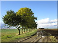
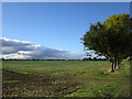
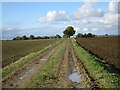
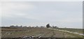
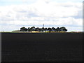
Living in West Lindsey District offers a distinctly rural lifestyle across eleven hundred and fifty-eight point two square kilometres. This local authority district stretches from the River Trent in the west to the Lincolnshire Wolds in the east. Gainsborough serves as the administrative centre and the largest town within the boundary. Market Rasen and Caistor stand as further important market towns for residents. The landscape is overwhelmingly rural, featuring agricultural settings, low-lying fertile clay valleys, and the rolling hills of the Lincolnshire Wolds Area of Outstanding Natural Beauty. Residents enjoy proximity to notable landmarks such as Gainsborough Old Hall, a medieval manor, and the historic Caistor, which has Roman origins. Market Rasen provides entertainment through its racecourse. The economy relies partly on light industry in Gainsborough, including the manufacture of hosiery and agricultural implements. These sectors have expanded since World War II. Much of the district remains defined by farmland and limestone ridges known as the Lincoln Edge. Families and individuals seeking a quieter life away from the city centre will find this area suitable. The distance from urban congestion allows for a slower pace while maintaining access to essential services in the main towns. You will find yourself navigating a mix of open countryside and established town centres.
- Area Type
- District/Borough
- Area Size
- 1158.2 km²
- Population
- Not available
- Population Density
- Not available
Demographics
The community in West Lindsey District is notably mature, with a median age of seventy years. This age profile indicates a significant resident base of older individuals. Home ownership stands at seventy-one per cent, which is a high level indicating that many residents have purchased their properties rather than renting. Household composition and accommodation type data are available but presented as aggregate totals rather than specific breakdowns of family sizes or property types. Ethnic diversity and religious affiliation figures are recorded as total aggregates for the district. A safety score of seventy out of one hundred suggests below-average crime rates compared to the broader national picture. This low crime risk reflects a generally stable neighbourhood environment. The high proportion of owner-occupiers often correlates with families and retirees choosing areas for stability and long-term living. The mature demographic may influence local service provision and community activities. Residents benefit from a peaceful setting where the majority have invested in their homes. This ownership structure fosters a sense of permanence within the local communities. You should expect a population where long-term residents dominate the neighbourhood statistics. The safety rating provides reassurance that daily life involves minimal friction regarding criminal activity in this part of Lincolnshire.
Household Size
Accommodation Type
Tenure
Ethnic Group
Religion
Household Composition
Age
Household Deprivation
NS-SEC
Explore more demographic insights in this area
Go to Demographics tabPlanning
Planning Constraints
- Flood RiskPremium
- Ramsar Wetland SitesPremium
- Area of Outstanding Natural BeautyPremium
- Protected Nature ReservePremium
- Protected WoodlandPremium