Area Overview for North Kesteven District
Photos of North Kesteven District
Area Information
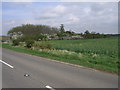
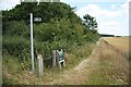
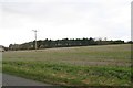
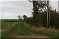
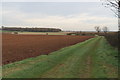
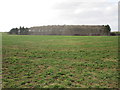
You can purchase homes in North Kesteven District without expecting the density found in major cities. This local authority district covers an extensive 922.9 km², placing it firmly in the rural category of Lincolnshire. The landscape is defined by spacious grounds and a sense of open space rather than urban sprawl. Living in North Kesteven District means relying on the countryside for your daily surroundings. You will find that life here revolves around a slower pace compared to metropolitan centres. The area remains a distinct community where property largely remains in stable, long-term hands.
- Area Type
- District/Borough
- Area Size
- 922.9 km²
- Population
- Not available
- Population Density
- Not available
Demographics
The community in North Kesteven District presents a unique snapshot of later-life living. The median age stands at 70 years, making this the oldest local constituency in the entire country. You are looking at a population structure where residents are predominantly retirees rather than young families or students. Home ownership levels reflect this demographic stability, with 74% of households owning their property outright or with a mortgage. This high figure indicates a settled population that has chosen to stay put. The percentage of renters is very low when compared to urban boroughs. You will not find the transient populations common in towns like London or Manchester here. The low crime risk score of 79 further supports the view of a secure environment for this older demographic.
Household Size
Accommodation Type
Tenure
Ethnic Group
Religion
Household Composition
Age
Household Deprivation
NS-SEC
Explore more demographic insights in this area
Go to Demographics tabPlanning
Planning Constraints
- Flood RiskPremium
- Ramsar Wetland SitesPremium
- Area of Outstanding Natural BeautyPremium
- Protected Nature ReservePremium
- Protected WoodlandPremium