Area Overview for LE8 5PH
Photos of LE8 5PH
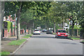
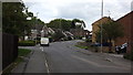
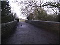
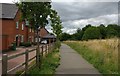
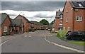
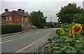
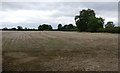
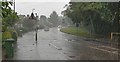
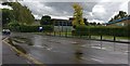
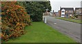
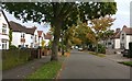
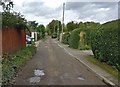
25 photos from this area
Area Information
Key information about the LE8 5PH including its size, population, and administrative classification.
- Area Type
- Postcode
- Area Size
- 3.4 hectares
- Population
- 1658
- Population Density
- 2979 people/km²
House Prices in LE8 5PH
37
Properties
£194,831
Average Sold Price
£58,950
Lowest Price
£340,000
Highest Price
Showing 37 properties
| Address | Type | Beds | Baths | Last Sale Price | Last Sale Date | |
|---|---|---|---|---|---|---|
| 42 Maurice Drive, Countesthorpe, LE8 5PH | Detached | 4 | 1 | £340,000 | Oct 2023 | |
| 10 Maurice Drive, Countesthorpe, LE8 5PH | Detached | 4 | 1 | £275,000 | Oct 2023 | |
| 7 Maurice Drive, Countesthorpe, LE8 5PH | Bungalow | 2 | 1 | £273,000 | Oct 2023 | |
| 28 Maurice Drive, Countesthorpe, LE8 5PH | Detached | 3 | 1 | £305,000 | Sep 2023 | |
| 5 Maurice Drive, Countesthorpe, LE8 5PH | Retail | 2 | 1 | £285,000 | Nov 2022 | |
| 13 Maurice Drive, Countesthorpe, LE8 5PH | house | - | - | £230,000 | Mar 2021 | |
| 15 Maurice Drive, Countesthorpe, LE8 5PH | house | - | - | £235,000 | Mar 2021 | |
| 9 Maurice Drive, Countesthorpe, LE8 5PH | Bungalow | 2 | 1 | £224,000 | May 2018 | |
| 8 Maurice Drive, Countesthorpe, LE8 5PH | Detached | 4 | - | £258,000 | Jan 2018 | |
| 2 Maurice Drive, Countesthorpe, LE8 5PH | Bungalow | 2 | 1 | £200,000 | May 2017 |
Page 1 of 4
Energy Efficiency in LE8 5PH
Amenities
Schools
| Rank | School | Type | Entry gender | Ages |
|---|
Explore more schools in this area
Go to Schools tabDemographics
Household Size
Two person
most common
Accommodation Type
Houses
most common
Tenure
72
majority
Ethnic Group
White
most common
Religion
N/A
most common
Household Composition
N/A
most common
Age
47
median
Adults (30-64 years)
most common
Household Deprivation
N/A
with no deprivation
NS-SEC
33
in Lower managerial occupations
Explore more demographic insights in this area
Go to Demographics tabPlanning
Planning Constraints
- Flood RiskPremium
- Ramsar Wetland SitesPremium
- Area of Outstanding Natural BeautyPremium
- Protected Nature ReservePremium
- Protected WoodlandPremium