Area Overview for LE8 5WR
Photos of LE8 5WR
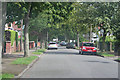
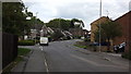
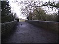
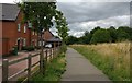
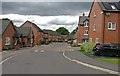
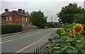
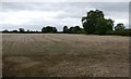
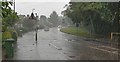
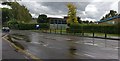
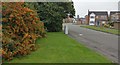
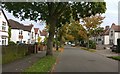
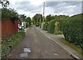
25 photos from this area
Area Information
Key information about the LE8 5WR including its size, population, and administrative classification.
- Area Type
- Postcode
- Area Size
- 2.4 hectares
- Population
- 1658
- Population Density
- 2979 people/km²
House Prices in LE8 5WR
18
Properties
£134,689
Average Sold Price
£48,450
Lowest Price
£225,000
Highest Price
Showing 18 properties
| Address | Type | Beds | Baths | Last Sale Price | Last Sale Date | |
|---|---|---|---|---|---|---|
| 9 Mennecy Close, Countesthorpe, LE8 5WR | Terraced | 3 | 1 | £225,000 | Jun 2023 | |
| 3 Mennecy Close, Countesthorpe, LE8 5WR | Terraced | - | - | £175,000 | Sep 2018 | |
| 16 Mennecy Close, Countesthorpe, LE8 5WR | Bungalow | 2 | 1 | £168,000 | Dec 2015 | |
| 4 Mennecy Close, Countesthorpe, LE8 5WR | Semi-detached | 3 | - | £145,000 | Jul 2015 | |
| 10 Mennecy Close, Countesthorpe, LE8 5WR | Terraced | 3 | 1 | £155,000 | Apr 2015 | |
| 7 Mennecy Close, Countesthorpe, LE8 5WR | Terraced | 3 | 1 | £143,000 | Jul 2014 | |
| 12 Mennecy Close, Countesthorpe, LE8 5WR | Terraced | 3 | - | £123,000 | Mar 2013 | |
| 1 Mennecy Close, Countesthorpe, LE8 5WR | Terraced | - | - | £135,000 | Aug 2007 | |
| 15 Mennecy Close, Countesthorpe, LE8 5WR | Detached | 2 | - | £172,000 | Nov 2006 | |
| 8 Mennecy Close, Countesthorpe, LE8 5WR | Terraced | - | - | £138,000 | Nov 2006 |
Page 1 of 2
Energy Efficiency in LE8 5WR
Amenities
Schools
| Rank | School | Type | Entry gender | Ages |
|---|
Explore more schools in this area
Go to Schools tabDemographics
Household Size
Two person
most common
Accommodation Type
Houses
most common
Tenure
72
majority
Ethnic Group
White
most common
Religion
N/A
most common
Household Composition
N/A
most common
Age
47
median
Adults (30-64 years)
most common
Household Deprivation
N/A
with no deprivation
NS-SEC
33
in Lower managerial occupations
Explore more demographic insights in this area
Go to Demographics tabPlanning
Planning Constraints
- Flood RiskPremium
- Ramsar Wetland SitesPremium
- Area of Outstanding Natural BeautyPremium
- Protected Nature ReservePremium
- Protected WoodlandPremium