Area Overview for LE7 7HN
Photos of LE7 7HN
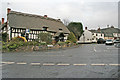
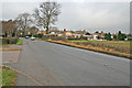
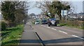
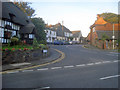
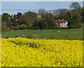
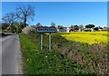
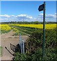
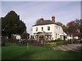
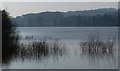
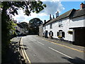
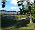
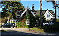
55 photos from this area
Area Information
Key information about the LE7 7HN including its size, population, and administrative classification.
- Area Type
- Postcode
- Area Size
- 1.3 hectares
- Population
- 1429
- Population Density
- 457 people/km²
House Prices in LE7 7HN
22
Properties
£265,042
Average Sold Price
£115,000
Lowest Price
£375,000
Highest Price
Showing 22 properties
| Address | Type | Beds | Baths | Last Sale Price | Last Sale Date | |
|---|---|---|---|---|---|---|
| 8 Waterfield Road, Cropston, LE7 7HN | Detached | 4 | 2 | £375,000 | Mar 2024 | |
| 28 Waterfield Road, Cropston, LE7 7HN | house | - | - | £375,000 | Aug 2017 | |
| 10 Waterfield Road, Cropston, LE7 7HN | Detached | 4 | 1 | £330,000 | Aug 2017 | |
| 32 Waterfield Road, Cropston, LE7 7HN | Detached | 4 | 1 | £286,000 | Jul 2017 | |
| 24 Waterfield Road, Cropston, LE7 7HN | Detached | 4 | - | £245,000 | May 2015 | |
| 4 Waterfield Road, Cropston, LE7 7HN | Detached | 4 | - | £290,000 | Feb 2014 | |
| 16 Waterfield Road, Cropston, LE7 7HN | Detached | - | - | £217,000 | Apr 2009 | |
| 36 Waterfield Road, Cropston, LE7 7HN | Detached | - | - | £297,500 | Feb 2008 | |
| 18 Waterfield Road, Cropston, LE7 7HN | Detached | - | - | £222,500 | Feb 2007 | |
| 12 Waterfield Road, Cropston, LE7 7HN | Detached | - | - | £265,500 | Apr 2006 |
Page 1 of 3
Energy Efficiency in LE7 7HN
Amenities
Schools
| Rank | School | Type | Entry gender | Ages |
|---|
Explore more schools in this area
Go to Schools tabDemographics
Household Size
Two person
most common
Accommodation Type
Houses
most common
Tenure
91
majority
Ethnic Group
White
most common
Religion
N/A
most common
Household Composition
N/A
most common
Age
47
median
Adults (30-64 years)
most common
Household Deprivation
N/A
with no deprivation
NS-SEC
48
in Lower managerial occupations
Explore more demographic insights in this area
Go to Demographics tabPlanning
Planning Constraints
- Flood RiskPremium
- Ramsar Wetland SitesPremium
- Area of Outstanding Natural BeautyPremium
- Protected Nature ReservePremium
- Protected WoodlandPremium