Area Overview for LE7 7GD
Photos of LE7 7GD
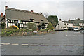
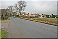
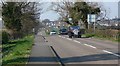
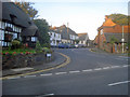
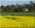
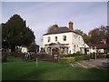
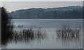
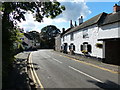
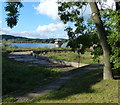
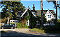
55 photos from this area
Area Information
Key information about the LE7 7GD including its size, population, and administrative classification.
- Area Type
- Postcode
- Area Size
- 95.0 hectares
- Population
- 1623
- Population Density
- 53 people/km²
House Prices in LE7 7GD
23
Properties
£395,197
Average Sold Price
£80,000
Lowest Price
£830,000
Highest Price
Showing 23 properties
| Address | Type | Beds | Baths | Last Sale Price | Last Sale Date | |
|---|---|---|---|---|---|---|
| 12 Causeway Lane, Cropston, LE7 7GD | Detached | 4 | 2 | £455,000 | Sep 2025 | |
| 23 Causeway Lane, Cropston, LE7 7GD | Bungalow | 3 | 2 | £695,000 | Jun 2025 | |
| 19 Causeway Lane, Cropston, LE7 7GD | Semi-detached | 3 | 1 | £195,000 | Apr 2024 | |
| 14 Causeway Lane, Cropston, LE7 7GD | house | - | - | £400,000 | Aug 2023 | |
| Cornerstone House, 18 Causeway Lane, Cropston, LE7 7GD | Detached | 4 | 3 | £565,000 | Dec 2018 | |
| 26 Causeway Lane, Cropston, LE7 7GD | Detached | - | - | £580,000 | Apr 2018 | |
| 7 Causeway Lane, Cropston, LE7 7GD | house | 3 | - | £224,950 | Sep 2015 | |
| 2 Causeway Lane, Cropston, LE7 7GD | house | - | - | £575,000 | Jul 2012 | |
| The Gate House, 20 Causeway Lane, Cropston, LE7 7GD | house | 5 | - | £830,000 | Nov 2011 | |
| 3 Causeway Lane, Cropston, LE7 7GD | house | - | - | £115,000 | Nov 2010 |
Page 1 of 3
Energy Efficiency in LE7 7GD
Amenities
Schools
| Rank | School | Type | Entry gender | Ages |
|---|
Explore more schools in this area
Go to Schools tabDemographics
Household Size
Two person
most common
Accommodation Type
Houses
most common
Tenure
89
majority
Ethnic Group
White
most common
Religion
N/A
most common
Household Composition
N/A
most common
Age
47
median
Adults (30-64 years)
most common
Household Deprivation
N/A
with no deprivation
NS-SEC
48
in Lower managerial occupations
Explore more demographic insights in this area
Go to Demographics tabPlanning
Planning Constraints
- Flood RiskPremium
- Ramsar Wetland SitesPremium
- Area of Outstanding Natural BeautyPremium
- Protected Nature ReservePremium
- Protected WoodlandPremium