Area Overview for LE7 7GE
Photos of LE7 7GE
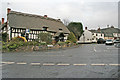
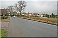
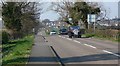
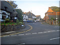
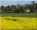
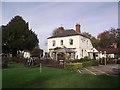

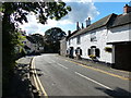
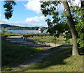
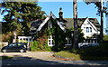
55 photos from this area
Area Information
Key information about the LE7 7GE including its size, population, and administrative classification.
- Area Type
- Postcode
- Area Size
- 2.2 hectares
- Population
- 1583
- Population Density
- 167 people/km²
House Prices in LE7 7GE
13
Properties
£363,661
Average Sold Price
£137,950
Lowest Price
£705,000
Highest Price
Showing 13 properties
| Address | Type | Beds | Baths | Last Sale Price | Last Sale Date | |
|---|---|---|---|---|---|---|
| 20 Cropston Road, Cropston, LE7 7GE | Bungalow | 2 | 1 | £350,000 | Dec 2024 | |
| 11 Cropston Road, Cropston, LE7 7GE | Semi-detached | 5 | 3 | £600,000 | Jan 2019 | |
| Reservoir House, 14 Cropston Road, Cropston, LE7 7GE | Detached | 4 | 3 | £705,000 | Nov 2016 | |
| The Mill Barn, 13 Cropston Road, Cropston, LE7 7GE | Terraced | - | - | £360,000 | Aug 2012 | |
| 15 Cropston Road, Cropston, LE7 7GE | Semi-detached | 3 | 2 | £270,000 | Jun 2011 | |
| 12 Cropston Road, Cropston, LE7 7GE | Land | 3 | - | £370,000 | Sep 2010 | |
| 16 Cropston Road, Cropston, LE7 7GE | Detached | - | - | £240,000 | Apr 2002 | |
| 9 Cropston Road, Cropston, LE7 7GE | Semi-detached | 3 | 2 | £137,950 | Oct 1998 | |
| The Old Slate Barn, 17 Cropston Road, Cropston, LE7 7GE | Detached | - | - | £240,000 | Sep 1997 | |
| 18 Cropston Road, Cropston, LE7 7GE | Detached | 5 | 3 | - | - |
Page 1 of 2
Energy Efficiency in LE7 7GE
Amenities
Schools
| Rank | School | Type | Entry gender | Ages |
|---|
Explore more schools in this area
Go to Schools tabDemographics
Household Size
Two person
most common
Accommodation Type
Houses
most common
Tenure
92
majority
Ethnic Group
White
most common
Religion
N/A
most common
Household Composition
N/A
most common
Age
47
median
Adults (30-64 years)
most common
Household Deprivation
N/A
with no deprivation
NS-SEC
52
in Lower managerial occupations
Explore more demographic insights in this area
Go to Demographics tabPlanning
Planning Constraints
- Flood RiskPremium
- Ramsar Wetland SitesPremium
- Area of Outstanding Natural BeautyPremium
- Protected Nature ReservePremium
- Protected WoodlandPremium