Area Overview for LE67 1GH
Photos of LE67 1GH


Area Information
Living in LE67 1GH means being part of a tightly knit residential cluster in England’s countryside. This postcode area spans just 3.6 hectares, housing 2,151 residents in a compact layout that fosters a close-knit community. The population density of 509 people per square kilometre reflects a balance between residential space and local amenities. Daily life here is shaped by a mature demographic, with a median age of 47 and most residents falling within the 30-64 age range. The area is predominantly owner-occupied, with 76% of homes in private hands, and the accommodation type is largely houses, not flats or apartments. Proximity to Ellistown Community Primary School, rated ‘good’ by Ofsted, and nearby retail outlets like Budgens Shell and Aldi Swinfen Vale ensures practicality for families. The small size of the area means that most services and transport links are within walking or short driving distance, making it ideal for those prioritising convenience and a quiet, stable environment.
- Area Type
- Postcode
- Area Size
- 3.6 hectares
- Population
- 2151
- Population Density
- 509 people/km²
The property market in LE67 1GH is characterised by high home ownership and a focus on houses rather than flats or apartments. With 76% of homes privately owned, the area is not a rental hotspot but rather a place where residents are likely to have long-term ties. The dominance of house-type properties suggests a preference for family homes, which may appeal to buyers seeking space and privacy. Given the small area size of 3.6 hectares, the housing stock is limited, meaning the market is likely to be competitive for those looking to buy or sell. Proximity to Ellistown Community Primary School and nearby retail outlets adds value, as these factors are often priorities for homebuyers. However, the compact nature of the area means that buyers should consider the immediate surroundings for additional housing options, as the postcode itself offers a limited range of properties.
House Prices in LE67 1GH
Showing 1 properties
| Address | Type | Beds | Baths | Last Sale Price | Last Sale Date | |
|---|---|---|---|---|---|---|
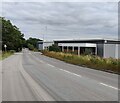
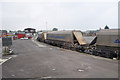
| Pos Direct Ltd, Regs Way, Bardon, LE67 1GH | Industrial | - | - | - | - |
Energy Efficiency in LE67 1GH
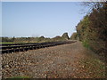
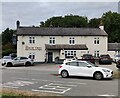
Life in LE67 1GH is shaped by its proximity to essential amenities and a compact layout that minimises travel time. The area’s retail offerings include five notable venues: Budgens Shell, Aldi Swinfen Vale, and Co-op Cropston, providing access to groceries, fuel, and everyday essentials. The Shackerstone Railway Station offers a direct link to broader transport networks, making it easier to commute to nearby towns or cities. While the area lacks extensive parks or leisure facilities, the nearby schools and shops contribute to a functional, community-oriented lifestyle. The small size of the postcode means that most amenities are within walking or short driving distance, fostering a sense of convenience. For those who prioritise practicality over sprawling green spaces, LE67 1GH offers a lifestyle where daily needs are met without the need for long journeys.
Amenities
Schools
The nearest school to LE67 1GH is Ellistown Community Primary School, a primary institution with a ‘good’ Ofsted rating. This school serves the local community and is likely to be a key consideration for families with young children. The absence of secondary schools in the immediate vicinity means that students may need to travel to nearby towns for further education, but the primary school’s quality rating suggests it provides a solid foundation for early learning. The presence of a well-rated primary school enhances the area’s appeal for families, as it reduces the need for long commutes to schools outside the postcode. For parents, this school’s proximity and performance are significant factors in assessing the suitability of LE67 1GH as a place to raise children.
| Rank | School | Type | Entry gender | Ages |
|---|
Explore more schools in this area
Go to Schools tabDemographics
The community in LE67 1GH is defined by its age profile and household composition. With a median age of 47, the area is predominantly populated by adults aged 30-64, suggesting a stable, mature demographic. Home ownership is high, at 76%, indicating a strong preference for long-term residency over rental properties. The accommodation type is largely houses, not flats or apartments, which aligns with the area’s character as a residential cluster rather than a high-density housing zone. The predominant ethnic group is White, reflecting the broader regional composition. The population density of 509 people per square kilometre, while relatively high for such a small area, suggests a mix of family homes and single-occupancy properties. This demographic profile implies a community focused on stability, with fewer transient residents and a strong emphasis on local amenities and schools.
Household Size
Accommodation Type
Tenure
Ethnic Group
Religion
Household Composition
Age
Household Deprivation
NS-SEC
Explore more demographic insights in this area
Go to Demographics tabPlanning
Planning Constraints
- Flood RiskPremium
- Ramsar Wetland SitesPremium
- Area of Outstanding Natural BeautyPremium
- Protected Nature ReservePremium
- Protected WoodlandPremium