Area Overview for LE67 1TB
Photos of LE67 1TB

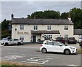
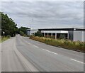
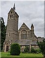
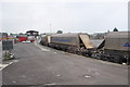
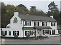


25 photos from this area
Area Information
Key information about the LE67 1TB including its size, population, and administrative classification.
- Area Type
- Postcode
- Area Size
- 40.6 hectares
- Population
- 2151
- Population Density
- 509 people/km²
House Prices in LE67 1TB
25
Properties
£232,167
Average Sold Price
£67,000
Lowest Price
£499,999
Highest Price
Showing 25 properties
| Address | Type | Beds | Baths | Last Sale Price | Last Sale Date | |
|---|---|---|---|---|---|---|
| Laughton Cottage, Beveridge Lane, Bardon, LE67 1TB | Terraced | 3 | 2 | £190,000 | Jul 2023 | |
| Bardon Lodge, Beveridge Lane, Bardon, LE67 1TB | Bungalow | 5 | 2 | £350,000 | Aug 2022 | |
| Rose Cottage, Beveridge Lane, Bardon, LE67 1TB | house | 3 | - | £160,000 | Apr 2022 | |
| Grangewood, Beveridge Lane, Bardon, LE67 1TB | house | - | - | £185,000 | Nov 2019 | |
| The Firs, Beveridge Lane, Bardon, LE67 1TB | house | 4 | 3 | £499,999 | Aug 2016 | |
| The Bungalow, Beveridge Lane, Bardon, LE67 1TB | Bungalow | - | - | £225,000 | Aug 2007 | |
| Suedale, Beveridge Lane, Bardon, LE67 1TB | Industrial | - | - | £87,500 | Jan 2003 | |
| Willow House, Beveridge Lane, Bardon, LE67 1TB | Detached | - | - | £325,000 | Nov 2002 | |
| Lymrey House, Beveridge Lane, Bardon, LE67 1TB | Detached | - | - | £67,000 | Apr 1995 | |
| Bardon View, Beveridge Lane, Bardon, LE67 1TB | Industrial | - | - | - | - |
Page 1 of 3
Energy Efficiency in LE67 1TB
Amenities
Schools
| Rank | School | Type | Entry gender | Ages |
|---|
Explore more schools in this area
Go to Schools tabDemographics
Household Size
Family (3-5 people)
most common
Accommodation Type
Houses
most common
Tenure
76
majority
Ethnic Group
White
most common
Religion
N/A
most common
Household Composition
N/A
most common
Age
47
median
Adults (30-64 years)
most common
Household Deprivation
N/A
with no deprivation
NS-SEC
27
in Lower managerial occupations
Explore more demographic insights in this area
Go to Demographics tabPlanning
Planning Constraints
- Flood RiskPremium
- Ramsar Wetland SitesPremium
- Area of Outstanding Natural BeautyPremium
- Protected Nature ReservePremium
- Protected WoodlandPremium