Area Overview for LE5 2FF
Photos of LE5 2FF
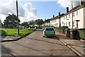
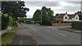
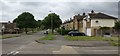
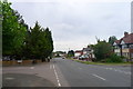
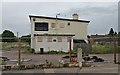
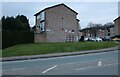
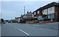
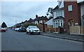
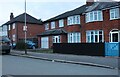
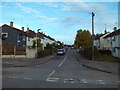
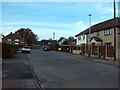
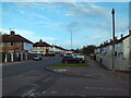
19 photos from this area
Area Information
Key information about the LE5 2FF including its size, population, and administrative classification.
- Area Type
- Postcode
- Area Size
- 1.4 hectares
- Population
- 1476
- Population Density
- 5593 people/km²
House Prices in LE5 2FF
22
Properties
£263,136
Average Sold Price
£51,500
Lowest Price
£590,000
Highest Price
Showing 22 properties
| Address | Type | Beds | Baths | Last Sale Price | Last Sale Date | |
|---|---|---|---|---|---|---|
| 137 Scraptoft Lane, Leicester, LE5 2FF | Semi-detached | 2 | 1 | £310,000 | Jan 2024 | |
| 129 Scraptoft Lane, Leicester, LE5 2FF | Semi-detached | 6 | 4 | £315,000 | Jul 2022 | |
| 145 Scraptoft Lane, Leicester, LE5 2FF | Semi-detached | 4 | 1 | £265,000 | Mar 2022 | |
| 153 Scraptoft Lane, Leicester, LE5 2FF | house | - | - | £590,000 | Jan 2022 | |
| 155 Scraptoft Lane, Leicester, LE5 2FF | Detached | 5 | 2 | £495,000 | Sep 2021 | |
| 149 Scraptoft Lane, Leicester, LE5 2FF | Detached | 3 | 2 | £285,000 | Sep 2017 | |
| 139 Scraptoft Lane, Leicester, LE5 2FF | Semi-detached | 3 | 2 | £145,000 | May 2013 | |
| 141 Scraptoft Lane, Leicester, LE5 2FF | house | - | - | £169,000 | Nov 2007 | |
| 147 Scraptoft Lane, Leicester, LE5 2FF | Semi-detached | 3 | 1 | £160,000 | Aug 2007 | |
| 159 Scraptoft Lane, Leicester, LE5 2FF | house | - | - | £109,000 | Sep 1998 |
Page 1 of 3
Energy Efficiency in LE5 2FF
Amenities
Schools
| Rank | School | Type | Entry gender | Ages |
|---|
Explore more schools in this area
Go to Schools tabDemographics
Household Size
Family (3-5 people)
most common
Accommodation Type
Houses
most common
Tenure
71
majority
Ethnic Group
asian_total
most common
Religion
N/A
most common
Household Composition
N/A
most common
Age
47
median
Adults (30-64 years)
most common
Household Deprivation
N/A
with no deprivation
NS-SEC
25
in Lower managerial occupations
Explore more demographic insights in this area
Go to Demographics tabPlanning
Planning Constraints
- Flood RiskPremium
- Ramsar Wetland SitesPremium
- Area of Outstanding Natural BeautyPremium
- Protected Nature ReservePremium
- Protected WoodlandPremium