Area Overview for LE5 2ER
Photos of LE5 2ER
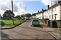
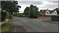
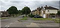
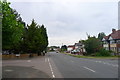
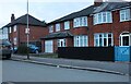
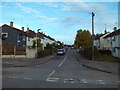
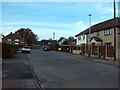
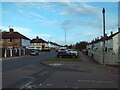
19 photos from this area
Area Information
Key information about the LE5 2ER including its size, population, and administrative classification.
- Area Type
- Postcode
- Area Size
- 2.1 hectares
- Population
- 1476
- Population Density
- 5593 people/km²
House Prices in LE5 2ER
39
Properties
£163,400
Average Sold Price
£69,950
Lowest Price
£300,000
Highest Price
Showing 39 properties
| Address | Type | Beds | Baths | Last Sale Price | Last Sale Date | |
|---|---|---|---|---|---|---|
| 71 Ocean Road, Leicester, LE5 2ER | Bungalow | - | - | £125,000 | Sep 2025 | |
| 63 Ocean Road, Leicester, LE5 2ER | Bungalow | 3 | 1 | £300,000 | Aug 2022 | |
| 73 Ocean Road, Leicester, LE5 2ER | Bungalow | 2 | 1 | £200,000 | Mar 2021 | |
| 59A Ocean Road, Leicester, LE5 2ER | Bungalow | 2 | 1 | £192,000 | May 2019 | |
| 7 Ocean Road, Leicester, LE5 2ER | Semi-detached | 3 | 1 | £158,000 | Feb 2017 | |
| 61A Ocean Road, Leicester, LE5 2ER | Bungalow | - | - | £157,000 | Feb 2006 | |
| 61 Ocean Road, Leicester, LE5 2ER | Detached | - | - | £105,250 | Jun 2000 | |
| 11 Ocean Road, Leicester, LE5 2ER | Detached | - | - | £69,950 | Oct 1997 | |
| Trinity Housing, Flat 1, 59 Ocean Road, Leicester, LE5 2ER | Bungalow | 5 | 2 | - | - | |
| 1 Ocean Road, Leicester, LE5 2ER | Terraced | - | - | - | - |
Page 1 of 4
Energy Efficiency in LE5 2ER
Amenities
Schools
| Rank | School | Type | Entry gender | Ages |
|---|
Explore more schools in this area
Go to Schools tabDemographics
Household Size
Family (3-5 people)
most common
Accommodation Type
Houses
most common
Tenure
71
majority
Ethnic Group
asian_total
most common
Religion
N/A
most common
Household Composition
N/A
most common
Age
47
median
Adults (30-64 years)
most common
Household Deprivation
N/A
with no deprivation
NS-SEC
25
in Lower managerial occupations
Explore more demographic insights in this area
Go to Demographics tabPlanning
Planning Constraints
- Flood RiskPremium
- Ramsar Wetland SitesPremium
- Area of Outstanding Natural BeautyPremium
- Protected Nature ReservePremium
- Protected WoodlandPremium