Area Overview for LE5 1HY
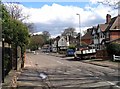
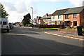
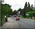
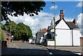
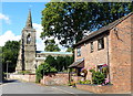
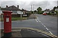
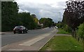
Photos of LE5 1HY


Area Information
Living in LE5 1HY means inhabiting a densely populated residential cluster in England, where 2005 residents are spread across just 1.3 hectares. This small area has a population density of 158,263 people per square kilometre, reflecting its compact nature. The community is predominantly composed of adults aged 30–64, with a median age of 47, suggesting a mature, established population. The area’s housing stock is largely owner-occupied, with 65% of homes owned by residents, and the accommodation type is primarily houses. This mix of demographics and property ownership creates a tight-knit, stable environment. Daily life here is shaped by proximity to retail, transport, and local services, though the area’s size means amenities are concentrated within a short radius. The presence of multiple rail and metro stations, including Leicester Railway Station and Leicester North, ensures strong connectivity to nearby towns and cities. However, the high density and limited space mean the area is best suited for those prioritising convenience over expansive living quarters.
- Area Type
- Postcode
- Area Size
- 1.3 hectares
- Population
- 2005
- Population Density
- 4479 people/km²
The property market in LE5 1HY is characterised by a high rate of home ownership, with 65% of properties owned by residents. The accommodation type is predominantly houses, which is unusual for areas of this size but suggests a preference for single-family homes. This composition implies a market where long-term residency is common, with limited turnover. The small area size means the housing stock is finite, which could affect availability for buyers. Those seeking properties here may find a focus on existing homes rather than new developments. The proximity to transport hubs like Leicester Railway Station and Leicester North adds to the area’s appeal for commuters, though the compact nature of LE5 1HY means buyers should prioritise proximity to amenities and consider the limitations of space. The market is likely to cater to those valuing convenience over expansive living areas, with homes primarily serving owner-occupied needs.
House Prices in LE5 1HY
No properties found in this postcode.
Energy Efficiency in LE5 1HY
Residents of LE5 1HY have access to a range of nearby amenities, including retail outlets such as Tesco Leicester, Iceland Uppingham, and Co-op Thurncourt, which provide essential shopping and grocery needs. The area’s proximity to rail stations like Leicester Railway Station and metro lines such as Great Central Railway ensures convenient travel for work, leisure, or socialising. While there are no major parks or leisure facilities directly within the postcode, the surrounding region likely offers recreational opportunities. The presence of Leicester Airport adds to the area’s connectivity, though it may not serve as a primary leisure destination. The compact nature of LE5 1HY means amenities are concentrated, requiring residents to navigate short distances between services. This setup suits those who prioritise convenience and proximity to transport, though it may limit options for those seeking expansive green spaces or cultural hubs.
Amenities
Schools
| Rank | School | Type | Entry gender | Ages |
|---|
Explore more schools in this area
Go to Schools tabDemographics
The population of LE5 1HY is 2005, with a median age of 47, indicating a community skewed towards middle-aged and older adults. The most common age range is 30–64 years, suggesting a mature demographic profile. Home ownership is high at 65%, with the majority of properties being houses rather than flats. The predominant ethnic group is Asian_total, reflecting a culturally specific community. This demographic structure implies a stable, long-term resident base with established family units. The area’s population density of 158,263 people per square kilometre is exceptionally high, which may impact living conditions and the availability of shared spaces. Despite this, the low crime risk score of 81 (level PASS) indicates a relatively safe environment. The combination of high home ownership, mature age groups, and cultural homogeneity shapes a community focused on stability and continuity.
Household Size
Accommodation Type
Tenure
Ethnic Group
Religion
Household Composition
Age
Household Deprivation
NS-SEC
Explore more demographic insights in this area
Go to Demographics tabPlanning
Planning Constraints
- Flood RiskPremium
- Ramsar Wetland SitesPremium
- Area of Outstanding Natural BeautyPremium
- Protected Nature ReservePremium
- Protected WoodlandPremium