Area Overview for LE17 4UB
Photos of LE17 4UB
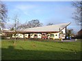
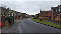
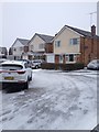
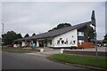
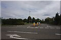
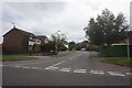
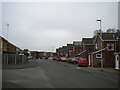
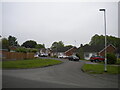

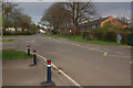
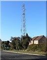

16 photos from this area
Area Information
Key information about the LE17 4UB including its size, population, and administrative classification.
- Area Type
- Postcode
- Area Size
- 19.5 hectares
- Population
- 2546
- Population Density
- 3070 people/km²
House Prices in LE17 4UB
30
Properties
£290,916
Average Sold Price
£96,000
Lowest Price
£476,099
Highest Price
Showing 30 properties
| Address | Type | Beds | Baths | Last Sale Price | Last Sale Date | |
|---|---|---|---|---|---|---|
| 15 Park Road, Lutterworth, LE17 4UB | Detached | 2 | 2 | £255,000 | Sep 2025 | |
| 22 Park Road, Lutterworth, LE17 4UB | Terraced | 2 | 1 | £120,000 | Feb 2025 | |
| 14 Park Road, Lutterworth, LE17 4UB | house | - | - | £96,000 | Jan 2025 | |
| 25 Park Road, Lutterworth, LE17 4UB | Detached | 3 | 3 | £375,000 | Dec 2024 | |
| 3 Park Road, Lutterworth, LE17 4UB | Semi-detached | 3 | 2 | £310,000 | May 2023 | |
| 13 Park Road, Lutterworth, LE17 4UB | Detached | 3 | 2 | £350,000 | Jul 2022 | |
| 6 Park Road, Lutterworth, LE17 4UB | Bungalow | - | - | £194,757 | Nov 2021 | |
| 16 Park Road, Lutterworth, LE17 4UB | house | - | - | £166,795 | Nov 2021 | |
| 34 Park Road, Lutterworth, LE17 4UB | Bungalow | - | - | £389,368 | Nov 2021 | |
| 7 Park Road, Lutterworth, LE17 4UB | Bungalow | - | - | £194,684 | Nov 2021 |
Page 1 of 3
Energy Efficiency in LE17 4UB
Amenities
Schools
| Rank | School | Type | Entry gender | Ages |
|---|
Explore more schools in this area
Go to Schools tabDemographics
Household Size
Two person
most common
Accommodation Type
Houses
most common
Tenure
88
majority
Ethnic Group
White
most common
Religion
N/A
most common
Household Composition
N/A
most common
Age
47
median
Adults (30-64 years)
most common
Household Deprivation
N/A
with no deprivation
NS-SEC
44
in Lower managerial occupations
Explore more demographic insights in this area
Go to Demographics tabPlanning
Planning Constraints
- Flood RiskPremium
- Ramsar Wetland SitesPremium
- Area of Outstanding Natural BeautyPremium
- Protected Nature ReservePremium
- Protected WoodlandPremium