Area Overview for LE17 4XJ
Photos of LE17 4XJ
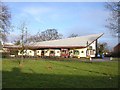
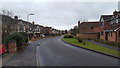
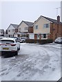
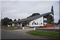
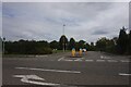
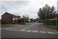
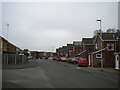
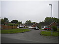


16 photos from this area
Area Information
Key information about the LE17 4XJ including its size, population, and administrative classification.
- Area Type
- Postcode
- Area Size
- 2.0 hectares
- Population
- 2546
- Population Density
- 3070 people/km²
House Prices in LE17 4XJ
34
Properties
£332,963
Average Sold Price
£2,000
Lowest Price
£625,000
Highest Price
Showing 34 properties
| Address | Type | Beds | Baths | Last Sale Price | Last Sale Date | |
|---|---|---|---|---|---|---|
| 14 Almond Way, Lutterworth, LE17 4XJ | Detached | 4 | 2 | £556,000 | Jul 2025 | |
| 32 Almond Way, Lutterworth, LE17 4XJ | Detached | 5 | 2 | £585,000 | Aug 2024 | |
| 21 Almond Way, Lutterworth, LE17 4XJ | house | - | - | £450,000 | Jul 2024 | |
| 3 Almond Way, Lutterworth, LE17 4XJ | house | - | - | £315,000 | Aug 2022 | |
| 18 Almond Way, Lutterworth, LE17 4XJ | Retail | 4 | 3 | £625,000 | Jul 2022 | |
| 20 Almond Way, Lutterworth, LE17 4XJ | house | - | - | £500,000 | May 2022 | |
| 16 Almond Way, Lutterworth, LE17 4XJ | Retail | 4 | - | £552,500 | Feb 2022 | |
| 19 Almond Way, Lutterworth, LE17 4XJ | Detached | 5 | - | £480,000 | Jun 2021 | |
| 28 Almond Way, Lutterworth, LE17 4XJ | house | - | - | £375,000 | May 2021 | |
| 29 Almond Way, Lutterworth, LE17 4XJ | Detached | 4 | - | £450,000 | Oct 2019 |
Page 1 of 4
Energy Efficiency in LE17 4XJ
Amenities
Schools
| Rank | School | Type | Entry gender | Ages |
|---|
Explore more schools in this area
Go to Schools tabDemographics
Household Size
Two person
most common
Accommodation Type
Houses
most common
Tenure
88
majority
Ethnic Group
White
most common
Religion
N/A
most common
Household Composition
N/A
most common
Age
47
median
Adults (30-64 years)
most common
Household Deprivation
N/A
with no deprivation
NS-SEC
44
in Lower managerial occupations
Explore more demographic insights in this area
Go to Demographics tabPlanning
Planning Constraints
- Flood RiskPremium
- Ramsar Wetland SitesPremium
- Area of Outstanding Natural BeautyPremium
- Protected Nature ReservePremium
- Protected WoodlandPremium