Area Overview for LE11 3RW
Photos of LE11 3RW
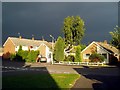
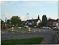
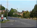
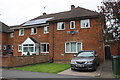
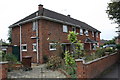
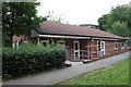
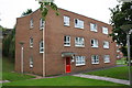
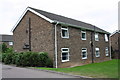
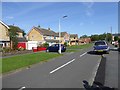
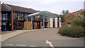
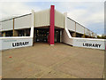
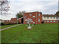
32 photos from this area
Area Information
Key information about the LE11 3RW including its size, population, and administrative classification.
- Area Type
- Postcode
- Area Size
- 2.8 hectares
- Population
- 1645
- Population Density
- 4256 people/km²
House Prices in LE11 3RW
41
Properties
£237,789
Average Sold Price
£59,950
Lowest Price
£499,950
Highest Price
Showing 41 properties
| Address | Type | Beds | Baths | Last Sale Price | Last Sale Date | |
|---|---|---|---|---|---|---|
| 66 Kirkstone Drive, Loughborough, LE11 3RW | Detached | 4 | 2 | £499,950 | Sep 2025 | |
| 72 Kirkstone Drive, Loughborough, LE11 3RW | Detached | 3 | 1 | £341,500 | May 2024 | |
| 86 Kirkstone Drive, Loughborough, LE11 3RW | Detached | 3 | 2 | £350,000 | Nov 2023 | |
| 24 Kirkstone Drive, Loughborough, LE11 3RW | house | - | - | £315,000 | Oct 2022 | |
| 22 Kirkstone Drive, Loughborough, LE11 3RW | Detached | 3 | 1 | £315,000 | Sep 2022 | |
| 70 Kirkstone Drive, Loughborough, LE11 3RW | house | - | - | £288,000 | Dec 2021 | |
| 46 Kirkstone Drive, Loughborough, LE11 3RW | Semi-detached | 3 | 1 | £270,000 | Jul 2021 | |
| 36 Kirkstone Drive, Loughborough, LE11 3RW | house | - | - | £275,000 | May 2021 | |
| 48 Kirkstone Drive, Loughborough, LE11 3RW | house | - | - | £339,000 | Feb 2021 | |
| 28 Kirkstone Drive, Loughborough, LE11 3RW | house | - | - | £300,000 | Feb 2021 |
Page 1 of 5
Energy Efficiency in LE11 3RW
Amenities
Schools
| Rank | School | Type | Entry gender | Ages |
|---|
Explore more schools in this area
Go to Schools tabDemographics
Household Size
Family (3-5 people)
most common
Accommodation Type
Houses
most common
Tenure
75
majority
Ethnic Group
White
most common
Religion
N/A
most common
Household Composition
N/A
most common
Age
47
median
Adults (30-64 years)
most common
Household Deprivation
N/A
with no deprivation
NS-SEC
31
in Lower managerial occupations
Explore more demographic insights in this area
Go to Demographics tabPlanning
Planning Constraints
- Flood RiskPremium
- Ramsar Wetland SitesPremium
- Area of Outstanding Natural BeautyPremium
- Protected Nature ReservePremium
- Protected WoodlandPremium