Area Overview for LE11 3HT
Photos of LE11 3HT


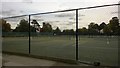
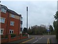
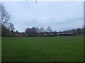
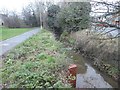
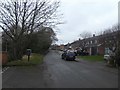

37 photos from this area
Area Information
Key information about the LE11 3HT including its size, population, and administrative classification.
- Area Type
- Postcode
- Area Size
- 2.6 hectares
- Population
- 1645
- Population Density
- 4256 people/km²
House Prices in LE11 3HT
36
Properties
£355,664
Average Sold Price
£60,000
Lowest Price
£785,000
Highest Price
Showing 36 properties
| Address | Type | Beds | Baths | Last Sale Price | Last Sale Date | |
|---|---|---|---|---|---|---|
| 273 Forest Road, Loughborough, LE11 3HT | house | 4 | - | £785,000 | Oct 2022 | |
| 293 Forest Road, Loughborough, LE11 3HT | Detached | 4 | 2 | £495,000 | Sep 2021 | |
| 255 Forest Road, Loughborough, LE11 3HT | Bungalow | 7 | 3 | £290,000 | Jun 2021 | |
| 239 Forest Road, Loughborough, LE11 3HT | house | - | - | £390,000 | Jun 2021 | |
| 297 Forest Road, Loughborough, LE11 3HT | Detached | 4 | 2 | £540,000 | Dec 2018 | |
| 243 Forest Road, Loughborough, LE11 3HT | Semi-detached | 3 | 2 | £256,000 | Sep 2018 | |
| 283 Forest Road, Loughborough, LE11 3HT | Detached | 6 | 2 | £555,000 | Aug 2018 | |
| 299 Forest Road, Loughborough, LE11 3HT | Detached | 4 | 1 | £380,000 | Jul 2018 | |
| 295 Forest Road, Loughborough, LE11 3HT | house | - | - | £412,000 | Jan 2018 | |
| 247 Forest Road, Loughborough, LE11 3HT | Detached | 4 | 1 | £465,000 | Sep 2017 |
Page 1 of 4
Energy Efficiency in LE11 3HT
Amenities
Schools
| Rank | School | Type | Entry gender | Ages |
|---|
Explore more schools in this area
Go to Schools tabDemographics
Household Size
Family (3-5 people)
most common
Accommodation Type
Houses
most common
Tenure
75
majority
Ethnic Group
White
most common
Religion
N/A
most common
Household Composition
N/A
most common
Age
47
median
Adults (30-64 years)
most common
Household Deprivation
N/A
with no deprivation
NS-SEC
31
in Lower managerial occupations
Explore more demographic insights in this area
Go to Demographics tabPlanning
Planning Constraints
- Flood RiskPremium
- Ramsar Wetland SitesPremium
- Area of Outstanding Natural BeautyPremium
- Protected Nature ReservePremium
- Protected WoodlandPremium