Area Overview for LE11 3JZ
Photos of LE11 3JZ
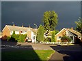
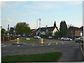
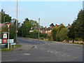
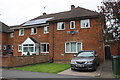
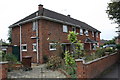
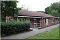
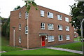
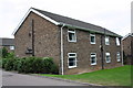
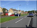
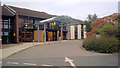
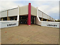
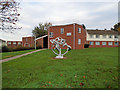
32 photos from this area
Area Information
Key information about the LE11 3JZ including its size, population, and administrative classification.
- Area Type
- Postcode
- Area Size
- 8813 m²
- Population
- 2292
- Population Density
- 3586 people/km²
House Prices in LE11 3JZ
17
Properties
£321,686
Average Sold Price
£71,950
Lowest Price
£1,700,000
Highest Price
Showing 17 properties
| Address | Type | Beds | Baths | Last Sale Price | Last Sale Date | |
|---|---|---|---|---|---|---|
| 108 Holywell Drive, Loughborough, LE11 3JZ | house | - | - | £1,700,000 | Mar 2024 | |
| 104 Holywell Drive, Loughborough, LE11 3JZ | Bungalow | - | - | £470,000 | Mar 2024 | |
| 110 Holywell Drive, Loughborough, LE11 3JZ | house | - | - | £268,000 | Feb 2024 | |
| 112 Holywell Drive, Loughborough, LE11 3JZ | house | - | - | £282,500 | May 2021 | |
| 116 Holywell Drive, Loughborough, LE11 3JZ | Semi-detached | 3 | 2 | £207,000 | Oct 2018 | |
| 100 Holywell Drive, Loughborough, LE11 3JZ | Bungalow | - | - | £226,000 | Dec 2017 | |
| 64 Holywell Drive, Loughborough, LE11 3JZ | Detached | 3 | 1 | £268,000 | Dec 2016 | |
| 68 Holywell Drive, Loughborough, LE11 3JZ | house | - | - | £270,000 | Jul 2015 | |
| 102 Holywell Drive, Loughborough, LE11 3JZ | Detached | - | - | £150,000 | Sep 2009 | |
| 114 Holywell Drive, Loughborough, LE11 3JZ | Semi-detached | 3 | 1 | £160,000 | Sep 2006 |
Page 1 of 2
Energy Efficiency in LE11 3JZ
Amenities
Schools
| Rank | School | Type | Entry gender | Ages |
|---|
Explore more schools in this area
Go to Schools tabDemographics
Household Size
Family (3-5 people)
most common
Accommodation Type
Houses
most common
Tenure
81
majority
Ethnic Group
White
most common
Religion
N/A
most common
Household Composition
N/A
most common
Age
22
median
Young Adults (15-29 years)
most common
Household Deprivation
N/A
with no deprivation
NS-SEC
23
in Lower managerial occupations
Explore more demographic insights in this area
Go to Demographics tabPlanning
Planning Constraints
- Flood RiskPremium
- Ramsar Wetland SitesPremium
- Area of Outstanding Natural BeautyPremium
- Protected Nature ReservePremium
- Protected WoodlandPremium