Area Overview for Unstone
Photos of Unstone
Area Information
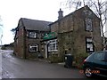
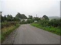
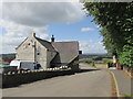
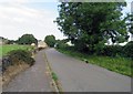
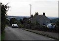
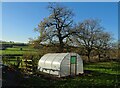
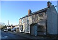
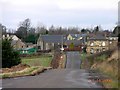
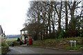
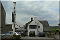
Unstone is a civil parish covering an area of 10.4 km² in the UK. Living in Unstone means embracing a rural lifestyle within a relatively small footprint. The location offers a quiet environment for those seeking space without the noise of major UK cities. Daily life here revolves around the tranquillity of the countryside and the relative seclusion of the parish. You will find that the pace of life is slower, with fewer immediate urban distractions. This setting appeals to individuals who prioritise natural surroundings and community intimacy over high-density living. The area size suggests ample room for gardens or land, which aligns well with the demographic profile of the residents. The character of Unstone is defined by its established nature. Prospective buyers looking for homes in Unstone should anticipate a traditional rural experience. There are no towering skyscrapers or busy motorways cutting through this specific parcel of England. Instead, the environment provides a backdrop for a settled way of life. You can expect to walk across open land and encounter familiar local streets quickly. The intimate scale of the parish ensures that the community remains cohesive. Families and retirees share the same spaces, creating a predictable and stable routine. If you value a straightforward existence with low traffic volumes, Unstone delivers exactly that.
- Area Type
- Parish
- Area Size
- 10.4 km²
- Population
- Not available
- Population Density
- Not available
Demographics
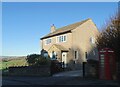
The community in Unstone has a distinct age profile, with a median age of 70. The most common age range covers the entire population, indicating that the area is not segmented by youth or middle-aged demographics. Living in Unstone means you are entering a settlement where residents largely belong to the older generation. This demographic skew explains the prevalence of permanent residents who have called the parish home for decades. You will find fewer young families moving here for work compared to urban centres with younger workforces. Home ownership levels in Unstone stand at 63%, reflecting a strong preference for owning property rather than renting. This figure suggests that many households have built their equity over a long period. The dominant accommodation type aligns with this ownership rate, presenting a mix of detached and semi-detached houses typical of older parishes. Ethnic diversity data is not explicitly detailed in the available breakdown, but the high ownership rate often correlates with long-standing local families. The household composition reflects a culture of stability, where people tend to stay put. Deprivation indicators are not broken down in the current data, but the high ownership rate and older age profile suggest a community where residents have secured their financial footing. If you are considering schools near Unstone, note that the local educational needs cater primarily to children in families that have settled here over time.
Household Size
Accommodation Type
Tenure
Ethnic Group
Religion
Household Composition
Age
Household Deprivation
NS-SEC
Explore more demographic insights in this area
Go to Demographics tabPlanning
Planning Constraints
- Flood RiskPremium
- Ramsar Wetland SitesPremium
- Area of Outstanding Natural BeautyPremium
- Protected Nature ReservePremium
- Protected WoodlandPremium