Area Overview for North East Derbyshire District
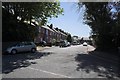
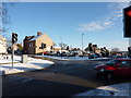
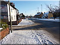
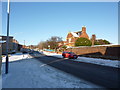
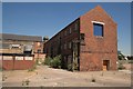
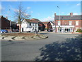
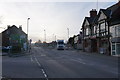
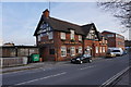
Photos of North East Derbyshire District
Area Information
Living in North East Derbyshire District offers a distinctly rural experience within the English county of Derbyshire. This local authority district covers a substantial area of 275.8 square kilometres, providing vast open spaces and a pace of life removed from urban density. You will find that daily life here is defined by proximity to nature and a community character shaped by significant past industrial histories in areas such as Coalville and Blidworth. The landscape is not untouched; protected nature reserves and woodlands are present throughout the district, adding layers of ecological importance to your surroundings. However, you should note that the district does not contain any Ramsar Wetland Sites or Areas of Outstanding Natural Beauty. These constraints are satisfied, meaning development proposals face fewer specific environmental hurdles compared to other parts of the country. Navigating this region requires planning due to its size, yet it retains a strong sense of place. You are entering a marketplace where property prices often reflect the specific town or village location rather than broad district trends. The mix of accommodation is shaped by long-standing residents and those drawn to the countryside. When you consider homes in North East Derbyshire District, you are selecting from a stock that is deeply embedded in local history. The area functions as a self-contained community for those seeking a quieter life, though you must factor in the distance to major city centres like Leicester or Nottingham for work or leisure. Your connection to the wider world will depend heavily on your chosen settlement within these 275.8 square kilometres.
- Area Type
- District/Borough
- Area Size
- 275.8 km²
- Population
- Not available
- Population Density
- Not available
Demographics
The community in North East Derbyshire District is defined by a notably older population. The median age across the district stands at 70 years, which is several years higher than the national average for England. This demographic profile indicates that you are moving into an area populated largely by retirees and long-term residents rather than young families or students. Consequently, the energy and social rhythm of the towns and villages reflect the interests of an older demographic. When you look at household composition, the data supports this picture, showing a region where empty nesters and elderly couples form the core of the population structure. Home ownership is the dominant form of tenure in this district. A striking 71 per cent of homes are owned outright or with a mortgage, compared to significantly lower rates across the rest of the UK. This high ownership rate suggests financial stability among residents and a culture where people buy rather than rent. You will find very few private landlords or large-scale rental complexes here. The remaining 29 per cent of households typically consist of private renters, shared ownership schemes, or those unable to secure a mortgage due to age. While specific data on predominant ethnic groups and religious affiliations is not detailed here, the demographic skew towards an older population is a defining feature. If you seek a diverse, young, fast-paced community, this location may not align with your expectations based on the age distribution alone.
Household Size
Accommodation Type
Tenure
Ethnic Group
Religion
Household Composition
Age
Household Deprivation
NS-SEC
Explore more demographic insights in this area
Go to Demographics tabPlanning
Planning Constraints
- Flood RiskPremium
- Ramsar Wetland SitesPremium
- Area of Outstanding Natural BeautyPremium
- Protected Nature ReservePremium
- Protected WoodlandPremium