Area Overview for Tupton
Photos of Tupton


Area Information
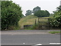
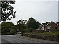
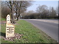
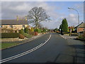
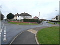
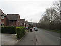
Tupton is a compact civil parish covering 2.3 km² in England. Living in Tupton means residing in a very tight-knit locality where every journey is measured in short distances. The area functions as a traditional community hub rather than a sprawling urban suburb. You will find a distinct lack of large-scale commercial development or industrial zones within these boundaries. Instead, the landscape is defined by residential streets and established neighbourhoods. The parish character remains intact, offering a quiet environment that contrasts with busier towns nearby. Daily life here revolves around local amenities and proximity to green spaces. The physical size of the area influences the pace of life. A 2.3 km² footprint means services are often within walking distance for residents. You do not need to travel far to access the core of the community or local parks. This compactness appeals to those seeking a slower lifestyle without total isolation. The layout supports a walkable environment where you can explore the parish on foot. Tupton offers a straightforward option for buyers who prioritise simplicity and a clear grasp of their immediate surroundings. It is not a place known for dramatic scenery or large estates, but rather for its manageable scale and defined boundaries. This straightforward nature makes assessing long commutes and daily logistics particularly easy for newcomers considering homes in Tupton.
- Area Type
- Parish
- Area Size
- 2.3 km²
- Population
- Not available
- Population Density
- Not available
Demographics
The people in Tupton reflect a community skewed towards later life stages. The median age stands at 70, marking this as a mature demographic hub. This figure indicates that the local population is significantly older than the national average. You will likely encounter retirees and pensioners as the predominant group within these streets. The most common age range aligns with this older profile, suggesting that families with young children or career-focused professionals form a minority. This age distribution often characterises areas where housing has historically catered to retirement income rather than first-time buyers. Home ownership sits at a substantial 72% across the parish. This high rate suggests that many residents have settled in Tupton permanently rather than renting transiently. You will find a community with deep-rooted local connections and long-term residency patterns. While the data does not specify breakdowns by ethnicity or religion, the overall homogeneity implied by the age and ownership figures points to a settled, stable neighbourhood. Living in Tupton involves joining a community where residents are accustomed to one another. The low turnover associated with high ownership levels creates an environment where local customs and routines remain consistent over decades. This stability offers predictability for those relocating here, though it may also mean the community is less receptive to rapid demographic shifts.
Household Size
Accommodation Type
Tenure
Ethnic Group
Religion
Household Composition
Age
Household Deprivation
NS-SEC
Explore more demographic insights in this area
Go to Demographics tabPlanning
Planning Constraints
- Flood RiskPremium
- Ramsar Wetland SitesPremium
- Area of Outstanding Natural BeautyPremium
- Protected Nature ReservePremium
- Protected WoodlandPremium