Area Overview for Birch Vale
Photos of Birch Vale
Area Information
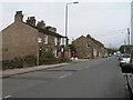
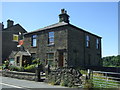
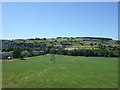
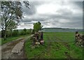
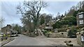
Living in Birch Vale offers a distinct blend of practicality and tranquility in a compact built-up area spanning 39.6 hectares. The community is characterised by a mature demographic, with a median age of 70, suggesting a population skewed towards older residents. This is reflected in the area’s high home ownership rate of 80%, indicating a stable, long-term presence of residents. Daily life here is likely shaped by proximity to essential services, including five retail outlets such as Sainsburys New Mills Torr and Co-op New, as well as five railway stations, including New Mills Central Railway Station. The area’s safety profile is notable, with a crime risk score of 74, placing it below average and offering reassurance to residents. Birch Vale is not a sprawling suburb but a focused, well-connected locale where practical needs are met without the congestion of larger towns. For those seeking a settled, low-crime environment with accessible amenities, Birch Vale presents a viable option.
- Area Type
- Built Up Area 250
- Area Size
- 39.6 hectares
- Population
- Not available
- Population Density
- Not available
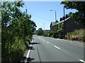
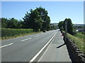
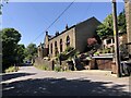
The lifestyle in Birch Vale is shaped by its proximity to practical amenities. Within reach are five retail outlets, including Sainsburys New Mills Torr and Co-op New, ensuring residents have access to groceries, household essentials, and daily conveniences. The area’s rail network, with stations such as New Mills Central Railway Station, offers easy access to broader regional connections. While the data does not mention parks or leisure facilities, the presence of multiple retail and transport options suggests a focus on functional living rather than recreational spaces. For those who value convenience over expansive leisure opportunities, Birch Vale provides a straightforward, no-frills lifestyle. The combination of retail and rail access means daily errands and travel are efficiently managed, supporting a practical, low-maintenance way of life.
Amenities
Schools
The only school explicitly listed near Birch Vale is Thornsett Primary School, part of the High Peak Federation, which holds an Ofsted rating of ‘good’. This provides a clear benchmark for families considering the area for primary education. The absence of secondary schools or other educational institutions in the data means that families may need to look beyond Birch Vale for comprehensive schooling options. However, the presence of a ‘good’-rated primary school is a positive factor, offering a reliable foundation for younger children’s education. The limited school data suggests that while Birch Vale may not be a destination for families seeking a full range of educational facilities, it does provide a solid starting point for primary schooling.
| Rank | School | Type | Entry gender | Ages |
|---|
Explore more schools in this area
Go to Schools tabDemographics
Birch Vale’s population is predominantly older, with a median age of 70, which is significantly higher than the national average. This suggests a community where retirement is the primary life stage, with fewer younger families or working-age residents. The home ownership rate of 80% indicates that most households are owner-occupied, which is typical of areas with older demographics and long-term residency. However, the data does not specify the types of households or accommodation, such as whether properties are terraced, semi-detached, or detached. The predominant ethnic group and religious composition are not detailed, but the area’s demographic profile implies a relatively homogeneous population. For buyers, this could mean a community with established social networks but fewer opportunities for family-oriented growth. The lack of specific data on deprivation or diversity means these aspects remain unexplored in the context of Birch Vale’s quality of life.