Area Overview for High Peak District (B)
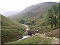
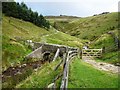
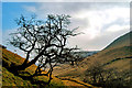
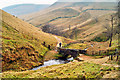
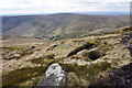
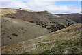
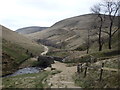
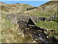
Photos of High Peak District (B)
Area Information
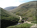
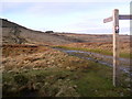
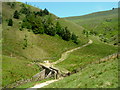
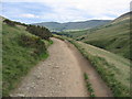
Living in High Peak District (B) means embracing a vast rural landscape spanning 540.6 square kilometres of southern Derbyshire. This extensive area offers plenty of open space and natural surroundings for those seeking privacy and quiet country living. You will find that daily life here revolves around a community defined by its significant age profile, with a median age of 70 years. Most residents are settled families or individuals enjoying retirement, rather than young professionals navigating busy city commutes. The district functions as a large local authority authority unitary area rather than a typical town centre district, meaning amenities may be spread out. You must plan your journey carefully to access facilities like shops, medical centres, and leisure options. The sheer size of the district means travel times can be longer than in more compact urban boroughs. This area suits those who prioritise wide horizons and nature over immediate access to high-street shopping. Homebuyers looking for traditional English countryside living will recognise the character of this expansive region immediately.
- Area Type
- District/Borough
- Area Size
- 540.6 km²
- Population
- Not available
- Population Density
- Not available
Demographics
The community in High Peak District (B) is distinctly older, with a median age of 70 years. This demographic profile reflects a population composed primarily of retirees and long-term residents. House ownership stands at an impressive 72%, indicating that the majority of households in this district own their homes outright or with a mortgage. A smaller proportion of residents rent their properties compared to more dynamic urban areas. While specific breakdowns for household composition, predominant ethnic groups, and religion are not detailed in the current records, the high ownership rate suggests a stable, rooted community. This stability often correlates with lower volatility in property values and a strong sense of local permanence. You will likely encounter neighbours who have lived in the area for decades, creating a fabric of established relationships. Deprivation data is not currently included in the provided statistics, but the high percentage of owner-occupiers usually signals a financially stable neighbourhood. Singles and empty nesters make up a significant portion of the demographic landscape here, shaping the social environment.
Household Size
Accommodation Type
Tenure
Ethnic Group
Religion
Household Composition
Age
Household Deprivation
NS-SEC
Explore more demographic insights in this area
Go to Demographics tabPlanning
Planning Constraints
- Flood RiskPremium
- Ramsar Wetland SitesPremium
- Area of Outstanding Natural BeautyPremium
- Protected Nature ReservePremium
- Protected WoodlandPremium