Area Overview for DE55 7LR
Photos of DE55 7LR
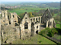
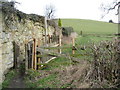
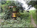
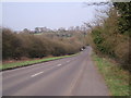
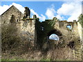
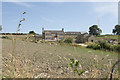
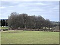
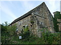
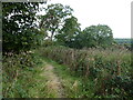
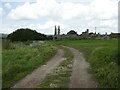
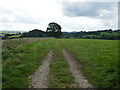
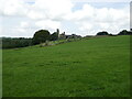
37 photos from this area
Area Information
Key information about the DE55 7LR including its size, population, and administrative classification.
- Area Type
- Postcode
- Area Size
- 1.4 km²
- Population
- 2314
- Population Density
- 115 people/km²
House Prices in DE55 7LR
26
Properties
£516,000
Average Sold Price
£233,000
Lowest Price
£715,000
Highest Price
Showing 26 properties
| Address | Type | Beds | Baths | Last Sale Price | Last Sale Date | |
|---|---|---|---|---|---|---|
| Field View Barn, Park Lane, South Wingfield, Alfreton, DE55 7LR | Bungalow | 3 | 2 | £715,000 | Mar 2025 | |
| Mill House, Park Lane, South Wingfield, Alfreton, DE55 7LR | house | - | - | £600,000 | Feb 2021 | |
| Mill Cottage, Park Lane, South Wingfield, Alfreton, DE55 7LR | house | - | - | £233,000 | Jul 2012 | |
| Bull Farm, Park Lane, Wingfield Park, Alfreton, DE55 7LR | Detached | 5 | 3 | - | - | |
| Park Lane Farm, Park Lane, South Wingfield, Alfreton, DE55 7LR | Semi-detached | 4 | - | - | - | |
| Park Farm, Park Lane, South Wingfield, Alfreton, DE55 7LR | Semi-detached | - | - | - | - | |
| The Bungalow At Old Shaft Farm, Park Lane, South Wingfield, Alfreton, DE55 7LR | Detached | - | - | - | - | |
| The Annexe, Shaw Wood Farm, Holme Lane, Oakerthorpe, Alfreton, DE55 7LR | Semi-detached | - | - | - | - | |
| The Nursery, Park Lane, Wingfield Park, Alfreton, DE55 7LR | commercial | - | - | - | - | |
| Old Shaft Farm, Park Lane, South Wingfield, Alfreton, DE55 7LR | Detached | - | - | - | - |
Page 1 of 3
Energy Efficiency in DE55 7LR
Amenities
Schools
| Rank | School | Type | Entry gender | Ages |
|---|
Explore more schools in this area
Go to Schools tabDemographics
Household Size
Two person
most common
Accommodation Type
Houses
most common
Tenure
81
majority
Ethnic Group
White
most common
Religion
N/A
most common
Household Composition
N/A
most common
Age
47
median
Adults (30-64 years)
most common
Household Deprivation
N/A
with no deprivation
NS-SEC
38
in Lower managerial occupations
Explore more demographic insights in this area
Go to Demographics tabPlanning
Planning Constraints
- Flood RiskPremium
- Ramsar Wetland SitesPremium
- Area of Outstanding Natural BeautyPremium
- Protected Nature ReservePremium
- Protected WoodlandPremium