Area Overview for DE4 5GY
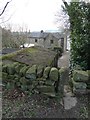
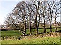
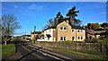
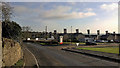
Photos of DE4 5GY

Area Information
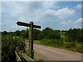
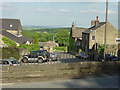
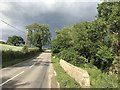
Living in DE4 5GY involves residing within a 2.1 km² residential cluster in Derbyshire, England. This small postcode covers 1542 people, creating a tight-knit environment where neighbours often know one another. The area sits at a population density of 168 people per km², which suggests a moderately populated community without the overcrowding found in larger towns. Residents here enjoy a suburban feel while remaining close enough to nearby towns for access to essential services. The landscape is defined by its rural character, distinct from the high-density buildings of urban centres. Daily life in this cluster balances quiet countryside living with reasonable access to local amenities. You are surrounded by a homogenous community structure where houses dominate the streets. The area is not large, so distances between homes and local facilities are short, making walking or cycling viable for many errands. This compact nature supports a slower pace of life, suitable for those who prefer a settled routine over the hustle of city living. The location offers a balance between isolation and accessibility, serving as a stable base for families and retirees alike.
- Area Type
- Postcode
- Area Size
- 2.1 km²
- Population
- 1542
- Population Density
- 168 people/km²
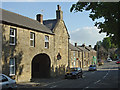
The property market in DE4 5GY is characterised by a strong ownership culture, with 80% of homes occupied by their owners. This high proportion of owner-occupation fundamentally shapes the local housing stock and market dynamics. The area predomiantly features houses, which reflects the historical development of the cluster as a residential zone for established families. You will rarely find purpose-built flats or large modern developments, as the accommodation type is defined by traditional detached or semi-detached properties. This market reality means that most transactions involve owners selling or upgrading rather than landlords seeking tenants. The sheer size of the postcode, covering only 2.1 km², limits the volume of available properties at any one time. Consequently, finding a specific size or style can require patience and thorough searching. Buyers looking for homes in DE4 5GY should expect a market driven by individual interests rather than a speculative rental sector. The prevalence of owner-occupiers often correlates with steady, modest price changes rather than the volatility seen in high-turnover rental markets.
House Prices in DE4 5GY
Showing 31 properties
| Address | Type | Beds | Baths | Last Sale Price | Last Sale Date | |
|---|---|---|---|---|---|---|
| Rough Farm, Park Head, Crich, Matlock, DE4 5GY | Detached | 4 | 3 | £850,000 | Dec 2023 | |
| High Ridge, Park Head, Crich, Matlock, DE4 5GY | Detached | 3 | 1 | £485,000 | Jun 2023 | |
| Beau Cottage, Mooredge Road, Park Head, Matlock, DE4 5GY | Detached | - | - | £135,000 | Apr 2020 | |
| Park Head Farm, Park Head, Crich, Matlock, DE4 5GY | Detached | 5 | 3 | £867,000 | Nov 2019 | |
| Edgemoor, Park Head, Crich, Matlock, DE4 5GY | Detached | 4 | 2 | £358,000 | Nov 2017 | |
| Park Head Cottage, Mooredge Road, Park Head, Matlock, DE4 5GY | house | 2 | 1 | £105,000 | Aug 2014 | |
| Croft Cottage, Park Head, Crich, Matlock, DE4 5GY | Terraced | - | - | £283,750 | Jan 2006 | |
| White Lodge, Park Head, Crich, Matlock, DE4 5GY | Detached | - | - | £197,000 | Aug 2002 | |
| Bracken Edge, Mooredge Road, Park Head, Matlock, DE4 5GY | Detached | - | - | £270,000 | Aug 2002 | |
| The Cottage, Park Head, Crich, Matlock, DE4 5GY | house | - | - | £115,000 | Dec 1996 |
Energy Efficiency in DE4 5GY
Your lifestyle in DE4 5GY is supported by a practical range of amenities located within practical reach of the postcode. For retail needs, you have access to five key options, most notably Budgens Crich, Morrisons Daily, and Tesco Alfreton. These stores provide sufficient grocery and shopping convenience without requiring a long journey into larger urban centres. Beyond food shopping, transport links are robust, with five railway stations noted as nearby points of connection. Whatstandwell Railway Station, Ambergate Railway Station, and Cromford Railway Station offer regular links to broader networks. Two Metro stations at Wirksworth and Idridgehay further extend your travel options for regional leisure or work. This connectivity means you can access wider entertainment and employment centres from the comfort of your local area. The presence of these specific stations ensures that you are not isolated despite the rural setting. Daily life involves a blend of local convenience and regional access. You can complete your shopping at Budgens or Tesco, then travel to Ambergate or Wirksworth for broader experiences. This balance defines the resident experience in this specific postcode cluster.
Amenities
Schools
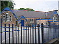
Families in DE4 5GY are served by two primary schools located very close to the postcode. Crich Junior School holds a good Ofsted rating, offering a solid educational foundation for younger children nearby. Similarly, Crich Carr CofE Primary School also carries a good Ofsted rating, providing an alternative for parents seeking slightly different educational approaches within the same convenient distance. Both institutions are rated good, ensuring that children do not have to travel far for quality primary education. The presence of two primary schools supports a community where school-run commutes are standard rather than undertaken by vehicle. The mix of schools being of the community/Church of England foundation type indicates a value placed on faith-based education options alongside standard programming. For parents living in DE4 5GY, this proximity reduces daily travel time significantly. You do not need to consult school catchment maps for distant locations, as these key institutions are immediately accessible. This arrangement supports working parents who need reliable, local schooling to complete their morning routines efficiently.
| Rank | School | Type | Entry gender | Ages |
|---|
Explore more schools in this area
Go to Schools tabDemographics
The community in DE4 5GY reflects a mature population with a median age of 47 years. Most residents fall into the adult age range of 30 to 64 years, indicating a settlement dominated by established households rather than young singles or students. This demographic profile explains the high level of homeownership, which stands at 80%. Such a figure signals that the area attracts people looking to settle down permanently rather than rent short-term. Housing in DE4 5GY consists almost entirely of houses, aligning with the older owner-occupier demographic. The predominant ethnic group in this cluster is White, contributing to a culturally consistent neighbourhood where long-standing local traditions likely persist. With three-quarters of the population being homeowners, you will find a community focused on investment in their property and stability. This demographic makeup often translates into lower transient rates, meaning you are more likely to encounter long-term residents than frequent movers. The age distribution and home ownership rate create a stable social fabric where residents often have deep roots in the local area.
Household Size
Accommodation Type
Tenure
Ethnic Group
Religion
Household Composition
Age
Household Deprivation
NS-SEC
Explore more demographic insights in this area
Go to Demographics tabPlanning
Planning Constraints
- Flood RiskPremium
- Ramsar Wetland SitesPremium
- Area of Outstanding Natural BeautyPremium
- Protected Nature ReservePremium
- Protected WoodlandPremium