Area Overview for DE5 3RH
Photos of DE5 3RH
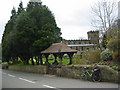
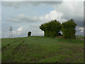
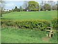
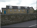


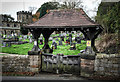
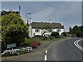
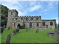
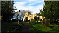
50 photos from this area
Area Information
Key information about the DE5 3RH including its size, population, and administrative classification.
- Area Type
- Postcode
- Area Size
- 1.1 km²
- Population
- 2314
- Population Density
- 115 people/km²
House Prices in DE5 3RH
20
Properties
£387,300
Average Sold Price
£129,000
Lowest Price
£600,000
Highest Price
Showing 20 properties
| Address | Type | Beds | Baths | Last Sale Price | Last Sale Date | |
|---|---|---|---|---|---|---|
| Rose Cottage, Pentrich Lane End, Pentrich, Ripley, DE5 3RH | Cottage | 3 | 2 | £525,000 | Mar 2025 | |
| Amberside Farm, Pentrich Lane End, Pentrich, Ripley, DE5 3RH | house | - | - | £600,000 | Mar 2017 | |
| South Cottage, Wood Lane, Pentrich, Ripley, DE5 3RH | house | - | - | £292,500 | Jun 2011 | |
| Lane End Farm, Wood Lane, Pentrich, Ripley, DE5 3RH | house | - | - | £390,000 | Mar 2007 | |
| Wood Lane Cottage, Wood Lane, Pentrich, Ripley, DE5 3RH | Semi-detached | - | - | £129,000 | May 2001 | |
| Devonshire House, Wingfield View, Pentrich Lane End, Pentrich, Ripley, DE5 3RH | Terraced | 3 | - | - | - | |
| Brandreth House, Wingfield View, Pentrich Lane End, Pentrich, Ripley, DE5 3RH | Terraced | 3 | - | - | - | |
| The Mill, Pentrich Lane End, Pentrich, Ripley, DE5 3RH | house | 4 | - | - | - | |
| Isaac House, Wingfield View, Pentrich Lane End, Pentrich, Ripley, DE5 3RH | Semi-detached | 3 | 3 | - | - | |
| Amberside, Pentrich Lane End, Pentrich, Ripley, DE5 3RH | Detached | 5 | - | - | - |
Page 1 of 2
Energy Efficiency in DE5 3RH
Amenities
Schools
| Rank | School | Type | Entry gender | Ages |
|---|
Explore more schools in this area
Go to Schools tabDemographics
Household Size
Two person
most common
Accommodation Type
Houses
most common
Tenure
81
majority
Ethnic Group
White
most common
Religion
N/A
most common
Household Composition
N/A
most common
Age
47
median
Adults (30-64 years)
most common
Household Deprivation
N/A
with no deprivation
NS-SEC
38
in Lower managerial occupations
Explore more demographic insights in this area
Go to Demographics tabPlanning
Planning Constraints
- Flood RiskPremium
- Ramsar Wetland SitesPremium
- Area of Outstanding Natural BeautyPremium
- Protected Nature ReservePremium
- Protected WoodlandPremium