Area Overview for DE55 6BL
Photos of DE55 6BL


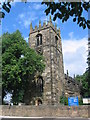


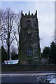
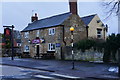
51 photos from this area
Area Information
Key information about the DE55 6BL including its size, population, and administrative classification.
- Area Type
- Postcode
- Area Size
- 3.8 hectares
- Population
- 1468
- Population Density
- 584 people/km²
House Prices in DE55 6BL
31
Properties
£227,929
Average Sold Price
£26,000
Lowest Price
£900,000
Highest Price
Showing 31 properties
| Address | Type | Beds | Baths | Last Sale Price | Last Sale Date | |
|---|---|---|---|---|---|---|
| Croftside, Town End, Shirland, DE55 6BL | house | 4 | 3 | £308,000 | Jul 2025 | |
| 21 Town End, Shirland, DE55 6BL | Detached | 3 | 1 | £297,000 | Dec 2022 | |
| Rutland House, Town End, Shirland, DE55 6BL | Detached | 4 | 3 | £355,000 | Mar 2019 | |
| Woolpack Croft, Town End, Shirland, DE55 6BL | Detached | - | - | £900,000 | Apr 2017 | |
| 16 Town End, Shirland, DE55 6BL | house | - | - | £450,000 | Jun 2016 | |
| 27 Town End, Shirland, DE55 6BL | Bungalow | 2 | - | £171,000 | Jul 2013 | |
| 39 Town End, Shirland, DE55 6BL | house | - | - | £125,000 | Dec 2010 | |
| 12 Town End, Shirland, DE55 6BL | Detached | 4 | 3 | £215,000 | Apr 2008 | |
| 31 Town End, Shirland, DE55 6BL | Detached | - | - | £174,000 | Jun 2005 | |
| 40 Town End, Shirland, DE55 6BL | Terraced | 1 | 1 | £27,000 | Nov 2001 |
Page 1 of 4
Energy Efficiency in DE55 6BL
Amenities
Schools
| Rank | School | Type | Entry gender | Ages |
|---|
Explore more schools in this area
Go to Schools tabDemographics
Household Size
Two person
most common
Accommodation Type
Houses
most common
Tenure
85
majority
Ethnic Group
White
most common
Religion
N/A
most common
Household Composition
N/A
most common
Age
47
median
Adults (30-64 years)
most common
Household Deprivation
N/A
with no deprivation
NS-SEC
28
in Lower managerial occupations
Explore more demographic insights in this area
Go to Demographics tabPlanning
Planning Constraints
- Flood RiskPremium
- Ramsar Wetland SitesPremium
- Area of Outstanding Natural BeautyPremium
- Protected Nature ReservePremium
- Protected WoodlandPremium