Area Overview for DE55 6BB
Photos of DE55 6BB


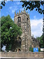


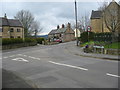
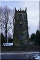
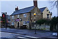
51 photos from this area
Area Information
Key information about the DE55 6BB including its size, population, and administrative classification.
- Area Type
- Postcode
- Area Size
- 8.2 hectares
- Population
- 1706
- Population Density
- 104 people/km²
House Prices in DE55 6BB
37
Properties
£161,461
Average Sold Price
£15,500
Lowest Price
£405,000
Highest Price
Showing 37 properties
| Address | Type | Beds | Baths | Last Sale Price | Last Sale Date | |
|---|---|---|---|---|---|---|
| 35 Main Road, Shirland, DE55 6BB | Retail | 2 | 1 | £95,000 | Apr 2022 | |
| 52 Main Road, Shirland, DE55 6BB | Semi-detached | 3 | - | £242,500 | Feb 2020 | |
| 33 Main Road, Shirland, DE55 6BB | Detached | 3 | - | £115,000 | Feb 2019 | |
| 22 Main Road, Shirland, DE55 6BB | Detached | 3 | - | £340,000 | Dec 2017 | |
| 20 Main Road, Shirland, DE55 6BB | house | - | - | £405,000 | Aug 2016 | |
| 16 Main Road, Shirland, DE55 6BB | Detached | 4 | - | £390,000 | Aug 2016 | |
| 57 Main Road, Shirland, DE55 6BB | house | 3 | - | £141,450 | Dec 2011 | |
| 55 Main Road, Shirland, DE55 6BB | Semi-detached | 3 | - | £150,000 | Jun 2010 | |
| 41 Main Road, Shirland, DE55 6BB | house | 2 | - | £70,500 | Mar 2005 | |
| 39 Main Road, Shirland, DE55 6BB | Terraced | - | - | £75,500 | Mar 2005 |
Page 1 of 4
Energy Efficiency in DE55 6BB
Amenities
Schools
| Rank | School | Type | Entry gender | Ages |
|---|
Explore more schools in this area
Go to Schools tabDemographics
Household Size
Two person
most common
Accommodation Type
Houses
most common
Tenure
73
majority
Ethnic Group
White
most common
Religion
N/A
most common
Household Composition
N/A
most common
Age
47
median
Adults (30-64 years)
most common
Household Deprivation
N/A
with no deprivation
NS-SEC
36
in Lower managerial occupations
Explore more demographic insights in this area
Go to Demographics tabPlanning
Planning Constraints
- Flood RiskPremium
- Ramsar Wetland SitesPremium
- Area of Outstanding Natural BeautyPremium
- Protected Nature ReservePremium
- Protected WoodlandPremium