Area Overview for DE55 6BN
Photos of DE55 6BN
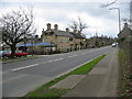
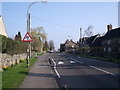
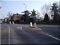
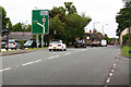
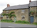
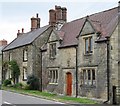
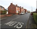
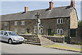
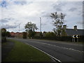
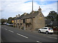
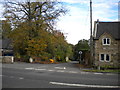
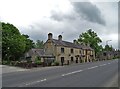
32 photos from this area
Area Information
Key information about the DE55 6BN including its size, population, and administrative classification.
- Area Type
- Postcode
- Area Size
- 3.3 hectares
- Population
- 1650
- Population Density
- 786 people/km²
House Prices in DE55 6BN
21
Properties
£106,727
Average Sold Price
£34,500
Lowest Price
£257,500
Highest Price
Showing 21 properties
| Address | Type | Beds | Baths | Last Sale Price | Last Sale Date | |
|---|---|---|---|---|---|---|
| 47 Chesterfield Road, Shirland, DE55 6BN | Detached | 4 | - | £257,500 | Sep 2022 | |
| 30 Chesterfield Road, Shirland, DE55 6BN | Bungalow | 3 | - | £192,500 | Jul 2017 | |
| 48 Chesterfield Road, Shirland, DE55 6BN | Semi-detached | 2 | - | £122,500 | Apr 2017 | |
| 55 Chesterfield Road, Shirland, DE55 6BN | house | 3 | - | £115,000 | Jul 2014 | |
| 53 Chesterfield Road, Shirland, DE55 6BN | Terraced | 2 | 1 | £55,000 | Dec 2012 | |
| 28 Chesterfield Road, Shirland, DE55 6BN | Bungalow | - | - | £124,500 | Jan 2011 | |
| 52 Chesterfield Road, Shirland, DE55 6BN | Semi-detached | - | - | £140,000 | Sep 2005 | |
| 44 Chesterfield Road, Shirland, DE55 6BN | Semi-detached | - | - | £47,000 | Mar 2001 | |
| 40 Chesterfield Road, Shirland, DE55 6BN | Semi-detached | - | - | £50,000 | Feb 2001 | |
| 46 Chesterfield Road, Shirland, DE55 6BN | Semi-detached | - | - | £34,500 | Aug 1997 |
Page 1 of 3
Energy Efficiency in DE55 6BN
Amenities
Schools
| Rank | School | Type | Entry gender | Ages |
|---|
Explore more schools in this area
Go to Schools tabDemographics
Household Size
Two person
most common
Accommodation Type
Houses
most common
Tenure
51
majority
Ethnic Group
White
most common
Religion
N/A
most common
Household Composition
N/A
most common
Age
47
median
Adults (30-64 years)
most common
Household Deprivation
N/A
with no deprivation
NS-SEC
23
in Lower managerial occupations
Explore more demographic insights in this area
Go to Demographics tabPlanning
Planning Constraints
- Flood RiskPremium
- Ramsar Wetland SitesPremium
- Area of Outstanding Natural BeautyPremium
- Protected Nature ReservePremium
- Protected WoodlandPremium