Area Overview for DE55 1AE
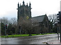
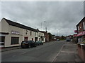
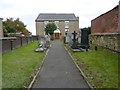
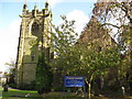
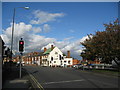
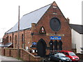
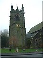
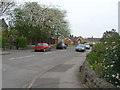
Photos of DE55 1AE
Area Information
Living in DE55 1AE means being part of a compact, residential cluster in England’s Derbyshire region. The area covers just 4.0 hectares, housing 1,319 residents in a densely populated 533 people per square kilometre. This small postcode is defined by its elderly population, with 65+ year-olds forming the largest age group. Daily life here is shaped by a mix of quiet living and practical access to nearby services. The area’s modest size means residents are close to essential amenities, though it remains a niche postcode with limited expansion potential. Its proximity to railway stations and a range of retail outlets suggests a balance between convenience and a slower pace of life. For those seeking a community with strong home ownership and a focus on traditional housing, DE55 1AE offers a distinct, if unassuming, alternative to larger urban centres.
- Area Type
- Postcode
- Area Size
- 4.0 hectares
- Population
- 1319
- Population Density
- 533 people/km²
DE55 1AE is a predominantly owner-occupied area, with 90% of homes owned by residents rather than rented. The accommodation type is almost entirely houses, which is unusual for a small postcode and suggests a focus on traditional, possibly larger properties. This composition implies limited rental availability and a market skewed towards long-term buyers seeking private, stable housing. The area’s compact size means property stock is finite, potentially driving competition among buyers. For those considering the area, the dominance of owner-occupied homes and the absence of flats or apartments may appeal to those prioritising space and privacy. However, the small scale of the postcode also means the surrounding regions may offer more varied options for those seeking different property types.
House Prices in DE55 1AE
Showing 3 properties
| Address | Type | Beds | Baths | Last Sale Price | Last Sale Date | |
|---|---|---|---|---|---|---|
| Swanwick Hall Cottage, The Green, Swanwick, Alfreton, DE55 1AE | undefined | - | - | - | - | |
| Tennis 177M From School House, Derby Road 156M From B6179, Derby Road, Swanwick, Alfreton, DE55 1AE | Leisure | - | - | - | - | |
| Swanwick Hall School, The Green, Swanwick, Alfreton, DE55 1AE | education | - | - | - | - |
Energy Efficiency in DE55 1AE
The lifestyle in DE55 1AE is shaped by its proximity to retail and transport hubs. Nearby amenities include Co-op Leabrooks, Heron Greenhill, and Iceland Alfreton, offering everyday shopping needs. The five railway stations provide access to broader networks, supporting both leisure and commuting. While the area is small, its residents benefit from a blend of practical retail options and reliable transport links. The lack of detailed data on parks or leisure facilities means the natural environment is not explicitly highlighted, but the absence of protected areas or wetlands suggests limited constraints on development. For those prioritising convenience, the mix of shops and rail access creates a functional daily life, though larger recreational opportunities may require venturing beyond the immediate area.
Amenities
Schools
Residents of DE55 1AE have access to a range of educational institutions, including Swanwick Hall School, a primary school, and Swanwick School and Sports College, a special school. A second entry for Swanwick Hall School notes it operates as an academy with a ‘good’ Ofsted rating. This mix of primary, special, and academy schools provides options for families with children of varying needs. The presence of a special school suggests the area may cater to students with specific educational requirements, while the academy status of Swanwick Hall School indicates a focus on performance and accountability. For parents, the combination of school types offers flexibility, though the lack of secondary schools nearby may require commuting. The ‘good’ rating at Swanwick Hall School adds value for families prioritising quality education.
| Rank | School | Type | Entry gender | Ages |
|---|
Explore more schools in this area
Go to Schools tabDemographics
The demographic profile of DE55 1AE is marked by a median age of 47, with the elderly (65+ years) comprising the largest age group. This suggests a community skewed towards older residents, potentially influencing local services and social dynamics. Home ownership is exceptionally high at 90%, indicating a stable, long-term resident base. The area is predominantly composed of houses, reflecting a preference for private, detached properties over flats or shared accommodation. The predominant ethnic group is White, though no specific data on diversity or deprivation is provided. The low population density of 533 people per square kilometre, combined with high home ownership, points to a semi-rural or suburban character. This demographic structure may affect local amenities, with services tailored to older adults and families prioritising private living spaces.
Household Size
Accommodation Type
Tenure
Ethnic Group
Religion
Household Composition
Age
Household Deprivation
NS-SEC
Explore more demographic insights in this area
Go to Demographics tabPlanning
Planning Constraints
- Flood RiskPremium
- Ramsar Wetland SitesPremium
- Area of Outstanding Natural BeautyPremium
- Protected Nature ReservePremium
- Protected WoodlandPremium