Area Overview for DE55 1AY
Photos of DE55 1AY
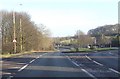
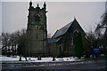
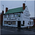
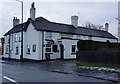
41 photos from this area
Area Information
Key information about the DE55 1AY including its size, population, and administrative classification.
- Area Type
- Postcode
- Area Size
- 1.5 hectares
- Population
- 1319
- Population Density
- 533 people/km²
House Prices in DE55 1AY
28
Properties
£160,536
Average Sold Price
£52,000
Lowest Price
£390,000
Highest Price
Showing 28 properties
| Address | Type | Beds | Baths | Last Sale Price | Last Sale Date | |
|---|---|---|---|---|---|---|
| 13 Broadway, Swanwick, Alfreton, DE55 1AY | Bungalow | 2 | 1 | £260,000 | Jun 2024 | |
| 25 Broadway, Swanwick, Alfreton, DE55 1AY | Bungalow | - | - | £235,000 | Oct 2022 | |
| 8 Broadway, Swanwick, Alfreton, DE55 1AY | Bungalow | - | - | £215,000 | Nov 2021 | |
| 25A Broadway, Swanwick, Alfreton, DE55 1AY | Bungalow | 5 | - | £390,000 | Oct 2020 | |
| 4 Broadway, Swanwick, Alfreton, DE55 1AY | Bungalow | - | - | £200,000 | Jul 2019 | |
| 26 Broadway, Swanwick, Alfreton, DE55 1AY | Bungalow | 2 | - | £195,000 | Aug 2018 | |
| 3 Broadway, Swanwick, Alfreton, DE55 1AY | Bungalow | 2 | - | £160,000 | Feb 2018 | |
| 15 Broadway, Swanwick, Alfreton, DE55 1AY | Bungalow | - | - | £165,000 | Mar 2016 | |
| 23 Broadway, Swanwick, Alfreton, DE55 1AY | Bungalow | - | - | £125,000 | Apr 2013 | |
| 7 Broadway, Swanwick, Alfreton, DE55 1AY | Bungalow | - | - | £104,700 | Feb 2012 |
Page 1 of 3
Energy Efficiency in DE55 1AY
Amenities
Schools
| Rank | School | Type | Entry gender | Ages |
|---|
Explore more schools in this area
Go to Schools tabDemographics
Household Size
Two person
most common
Accommodation Type
Houses
most common
Tenure
90
majority
Ethnic Group
White
most common
Religion
N/A
most common
Household Composition
N/A
most common
Age
47
median
Elderly (65+ years)
most common
Household Deprivation
N/A
with no deprivation
NS-SEC
36
in Lower managerial occupations
Explore more demographic insights in this area
Go to Demographics tabPlanning
Planning Constraints
- Flood RiskPremium
- Ramsar Wetland SitesPremium
- Area of Outstanding Natural BeautyPremium
- Protected Nature ReservePremium
- Protected WoodlandPremium