Area Overview for DE23 8TE
Photos of DE23 8TE
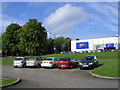

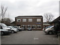
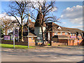
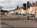
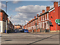
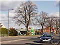
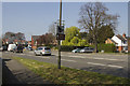
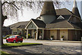
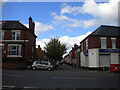
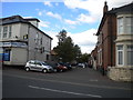
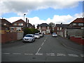
52 photos from this area
Area Information
Key information about the DE23 8TE including its size, population, and administrative classification.
- Area Type
- Postcode
- Area Size
- 6797 m²
- Population
- 1861
- Population Density
- 8256 people/km²
House Prices in DE23 8TE
45
Properties
£69,444
Average Sold Price
£5,075
Lowest Price
£133,000
Highest Price
Showing 45 properties
| Address | Type | Beds | Baths | Last Sale Price | Last Sale Date | |
|---|---|---|---|---|---|---|
| 86 Randolph Road, Derby, DE23 8TE | Terraced | 2 | 1 | £126,000 | May 2025 | |
| 84 Randolph Road, Derby, DE23 8TE | house | 2 | - | £95,000 | Apr 2023 | |
| 98 Randolph Road, Derby, DE23 8TE | Terraced | 2 | 1 | £90,000 | Feb 2023 | |
| 16 Randolph Road, Derby, DE23 8TE | house | 2 | - | £133,000 | Aug 2022 | |
| 80 Randolph Road, Derby, DE23 8TE | house | 3 | - | £127,000 | Jul 2022 | |
| 8 Randolph Road, Derby, DE23 8TE | Terraced | 2 | 1 | £95,000 | Sep 2021 | |
| 76 Randolph Road, Derby, DE23 8TE | house | - | - | £100,000 | Sep 2021 | |
| 104 Randolph Road, Derby, DE23 8TE | house | - | - | £51,975 | Feb 2020 | |
| 102 Randolph Road, Derby, DE23 8TE | house | 2 | - | £65,000 | Jul 2018 | |
| 92 Randolph Road, Derby, DE23 8TE | Terraced | 2 | 1 | £69,000 | May 2018 |
Page 1 of 5
Energy Efficiency in DE23 8TE
Amenities
Schools
| Rank | School | Type | Entry gender | Ages |
|---|
Explore more schools in this area
Go to Schools tabDemographics
Household Size
Family (3-5 people)
most common
Accommodation Type
Houses
most common
Tenure
58
majority
Ethnic Group
asian_total
most common
Religion
N/A
most common
Household Composition
N/A
most common
Age
47
median
Adults (30-64 years)
most common
Household Deprivation
N/A
with no deprivation
NS-SEC
13
in Lower managerial occupations
Explore more demographic insights in this area
Go to Demographics tabPlanning
Planning Constraints
- Flood RiskPremium
- Ramsar Wetland SitesPremium
- Area of Outstanding Natural BeautyPremium
- Protected Nature ReservePremium
- Protected WoodlandPremium