Area Overview for DE23 8SY
Photos of DE23 8SY

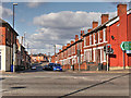
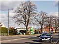
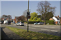
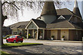
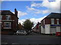
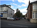
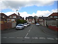
52 photos from this area
Area Information
Key information about the DE23 8SY including its size, population, and administrative classification.
- Area Type
- Postcode
- Area Size
- 1.4 hectares
- Population
- 1861
- Population Density
- 8256 people/km²
House Prices in DE23 8SY
46
Properties
£96,779
Average Sold Price
£13,000
Lowest Price
£220,000
Highest Price
Showing 46 properties
| Address | Type | Beds | Baths | Last Sale Price | Last Sale Date | |
|---|---|---|---|---|---|---|
| 226 St Thomas Road, Derby, DE23 8SY | house | 3 | 1 | £155,000 | Nov 2023 | |
| 242 St Thomas Road, Derby, DE23 8SY | Terraced | 5 | 2 | £220,000 | Oct 2022 | |
| 254 St Thomas Road, Derby, DE23 8SY | Terraced | 2 | 1 | £124,950 | May 2021 | |
| 206 St Thomas Road, Derby, DE23 8SY | house | - | - | £205,000 | Mar 2021 | |
| 266 St Thomas Road, Derby, DE23 8SY | Semi-detached | - | - | £180,000 | Feb 2020 | |
| 218 St Thomas Road, Derby, DE23 8SY | Semi-detached | 3 | 1 | £119,638 | Nov 2017 | |
| 212 St Thomas Road, Derby, DE23 8SY | house | 3 | - | £85,000 | Mar 2012 | |
| 260 St Thomas Road, Derby, DE23 8SY | house | - | - | £117,000 | Sep 2007 | |
| 216 St Thomas Road, Derby, DE23 8SY | Terraced | 3 | 1 | £92,000 | Aug 2006 | |
| 228 St Thomas Road, Derby, DE23 8SY | Semi-detached | - | - | £145,000 | Mar 2006 |
Page 1 of 5
Energy Efficiency in DE23 8SY
Amenities
Schools
| Rank | School | Type | Entry gender | Ages |
|---|
Explore more schools in this area
Go to Schools tabDemographics
Household Size
Family (3-5 people)
most common
Accommodation Type
Houses
most common
Tenure
58
majority
Ethnic Group
asian_total
most common
Religion
N/A
most common
Household Composition
N/A
most common
Age
47
median
Adults (30-64 years)
most common
Household Deprivation
N/A
with no deprivation
NS-SEC
13
in Lower managerial occupations
Explore more demographic insights in this area
Go to Demographics tabPlanning
Planning Constraints
- Flood RiskPremium
- Ramsar Wetland SitesPremium
- Area of Outstanding Natural BeautyPremium
- Protected Nature ReservePremium
- Protected WoodlandPremium