Area Overview for DE23 6RE
Photos of DE23 6RE
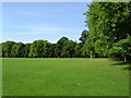
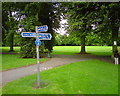
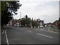
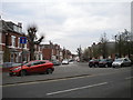
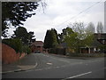
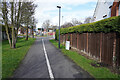
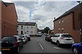
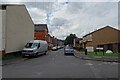
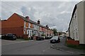
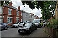
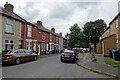
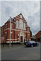
33 photos from this area
Area Information
Key information about the DE23 6RE including its size, population, and administrative classification.
- Area Type
- Postcode
- Area Size
- 2748 m²
- Population
- 2092
- Population Density
- 11616 people/km²
House Prices in DE23 6RE
18
Properties
£83,300
Average Sold Price
£26,450
Lowest Price
£119,000
Highest Price
Showing 18 properties
| Address | Type | Beds | Baths | Last Sale Price | Last Sale Date | |
|---|---|---|---|---|---|---|
| 163 Porter Road, Derby, DE23 6RE | Terraced | 3 | - | £104,000 | Jan 2017 | |
| 161 Porter Road, Derby, DE23 6RE | Terraced | 3 | 2 | £95,000 | Feb 2016 | |
| 175 Porter Road, Derby, DE23 6RE | Terraced | 3 | - | £77,000 | Aug 2014 | |
| 157 Porter Road, Derby, DE23 6RE | house | 3 | - | £102,000 | Aug 2011 | |
| 167 Porter Road, Derby, DE23 6RE | Terraced | - | - | £99,950 | Nov 2007 | |
| 173 Porter Road, Derby, DE23 6RE | house | - | - | £119,000 | Oct 2006 | |
| 155 Porter Road, Derby, DE23 6RE | house | - | - | £43,000 | Dec 2001 | |
| 171 Porter Road, Derby, DE23 6RE | Terraced | - | - | £26,450 | Apr 2001 | |
| 177 Porter Road, Derby, DE23 6RE | Terraced | - | - | - | - | |
| 175-177 Porter Road, Derby, DE23 6RE | Terraced | - | - | - | - |
Page 1 of 2
Energy Efficiency in DE23 6RE
Amenities
Schools
| Rank | School | Type | Entry gender | Ages |
|---|
Explore more schools in this area
Go to Schools tabDemographics
Household Size
Family (3-5 people)
most common
Accommodation Type
Houses
most common
Tenure
73
majority
Ethnic Group
asian_total
most common
Religion
N/A
most common
Household Composition
N/A
most common
Age
47
median
Adults (30-64 years)
most common
Household Deprivation
N/A
with no deprivation
NS-SEC
23
in Lower managerial occupations
Explore more demographic insights in this area
Go to Demographics tabPlanning
Planning Constraints
- Flood RiskPremium
- Ramsar Wetland SitesPremium
- Area of Outstanding Natural BeautyPremium
- Protected Nature ReservePremium
- Protected WoodlandPremium