Area Overview for DE22 1FW
Photos of DE22 1FW
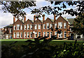
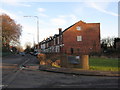
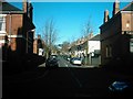
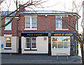
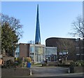
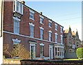
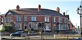
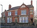
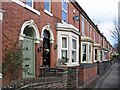
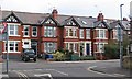
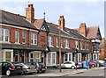
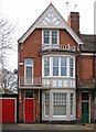
62 photos from this area
Area Information
Key information about the DE22 1FW including its size, population, and administrative classification.
- Area Type
- Postcode
- Area Size
- 4178 m²
- Population
- 2247
- Population Density
- 3590 people/km²
House Prices in DE22 1FW
31
Properties
£263,450
Average Sold Price
£83,500
Lowest Price
£365,000
Highest Price
Showing 31 properties
| Address | Type | Beds | Baths | Last Sale Price | Last Sale Date | |
|---|---|---|---|---|---|---|
| 90 Kedleston Road, Derby, DE22 1FW | Terraced | 5 | 2 | £365,000 | Nov 2022 | |
| 98 Kedleston Road, Derby, DE22 1FW | house | - | - | £360,000 | Feb 2022 | |
| 98A Kedleston Road, Derby, DE22 1FW | house | - | - | £284,350 | Sep 2021 | |
| 88 Kedleston Road, Derby, DE22 1FW | Terraced | 4 | 2 | £258,000 | Feb 2018 | |
| 108 Kedleston Road, Derby, DE22 1FW | Terraced | 5 | 2 | £320,000 | Aug 2017 | |
| 86 Kedleston Road, Derby, DE22 1FW | Terraced | 1 | 3 | £190,000 | Mar 2016 | |
| 94 Kedleston Road, Derby, DE22 1FW | Terraced | 6 | 4 | £240,000 | Jun 2015 | |
| 106 Kedleston Road, Derby, DE22 1FW | Terraced | - | - | £320,000 | Sep 2013 | |
| 104 Kedleston Road, Derby, DE22 1FW | house | - | - | £281,100 | Dec 2011 | |
| 112 Kedleston Road, Derby, DE22 1FW | Terraced | - | - | £196,000 | Feb 2003 |
Page 1 of 4
Energy Efficiency in DE22 1FW
Amenities
Schools
| Rank | School | Type | Entry gender | Ages |
|---|
Explore more schools in this area
Go to Schools tabDemographics
Household Size
One person
most common
Accommodation Type
Houses
most common
Tenure
53
majority
Ethnic Group
White
most common
Religion
N/A
most common
Household Composition
N/A
most common
Age
47
median
Adults (30-64 years)
most common
Household Deprivation
N/A
with no deprivation
NS-SEC
40
in Lower managerial occupations
Explore more demographic insights in this area
Go to Demographics tabPlanning
Planning Constraints
- Flood RiskPremium
- Ramsar Wetland SitesPremium
- Area of Outstanding Natural BeautyPremium
- Protected Nature ReservePremium
- Protected WoodlandPremium