Area Overview for DE22 1FR
Photos of DE22 1FR
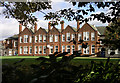
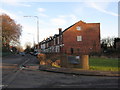
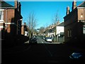
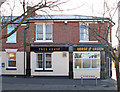
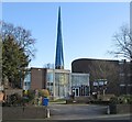
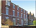
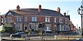
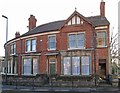
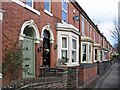
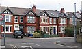
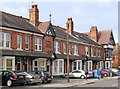
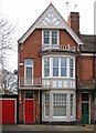
62 photos from this area
Area Information
Key information about the DE22 1FR including its size, population, and administrative classification.
- Area Type
- Postcode
- Area Size
- 7540 m²
- Population
- 1942
- Population Density
- 5467 people/km²
House Prices in DE22 1FR
37
Properties
£185,863
Average Sold Price
£70,500
Lowest Price
£350,000
Highest Price
Showing 37 properties
| Address | Type | Beds | Baths | Last Sale Price | Last Sale Date | |
|---|---|---|---|---|---|---|
| 77 Kedleston Road, Derby, DE22 1FR | house | - | - | £350,000 | Sep 2021 | |
| 85 Kedleston Road, Derby, DE22 1FR | house | - | - | £299,950 | Aug 2020 | |
| 81 Kedleston Road, Derby, DE22 1FR | Terraced | 3 | 1 | £219,000 | Nov 2016 | |
| 113 Kedleston Road, Derby, DE22 1FR | Terraced | 4 | 1 | £260,000 | Jul 2016 | |
| 79 Kedleston Road, Derby, DE22 1FR | Terraced | 3 | - | £178,000 | Mar 2016 | |
| 83 Kedleston Road, Derby, DE22 1FR | house | - | - | £205,000 | Jun 2011 | |
| 91 Kedleston Road, Derby, DE22 1FR | house | 4 | 1 | £157,000 | Feb 2011 | |
| 75 Kedleston Road, Derby, DE22 1FR | house | 5 | - | £200,000 | Dec 2009 | |
| 71 Kedleston Road, Derby, DE22 1FR | Unknown | 3 | - | £215,000 | Jan 2007 | |
| 97 Kedleston Road, Derby, DE22 1FR | house | - | - | £233,000 | Feb 2003 |
Page 1 of 4
Energy Efficiency in DE22 1FR
Amenities
Schools
| Rank | School | Type | Entry gender | Ages |
|---|
Explore more schools in this area
Go to Schools tabDemographics
Household Size
One person
most common
Accommodation Type
Flats
most common
Tenure
26
majority
Ethnic Group
White
most common
Religion
N/A
most common
Household Composition
N/A
most common
Age
22
median
Young Adults (15-29 years)
most common
Household Deprivation
N/A
with no deprivation
NS-SEC
19
in Lower managerial occupations
Explore more demographic insights in this area
Go to Demographics tabPlanning
Planning Constraints
- Flood RiskPremium
- Ramsar Wetland SitesPremium
- Area of Outstanding Natural BeautyPremium
- Protected Nature ReservePremium
- Protected WoodlandPremium