Area Overview for DE11 0UY
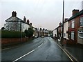
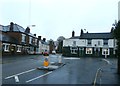
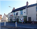
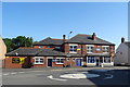
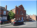
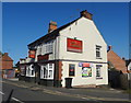
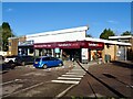
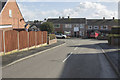
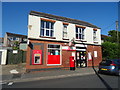
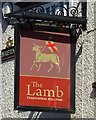
Photos of DE11 0UY


Area Information
Living in DE11 0UY means being part of a compact, densely populated residential cluster in South Derbyshire, England. The area covers 2,997 m² and is home to 1,740 people, making it one of the most densely populated places in the country at 580,658 people per km². Positioned between Swadlincote to the south and Burton upon Trent to the west, it lies near the A444 and A511 roads, with easy access to the M42 motorway. Historically shaped by 18th-century industrial activity in coal and clay, the area has evolved into a quiet residential hub. Its small size means a tight-knit community feel, with local landmarks like Newhall Park’s war memorial and St John’s Anglican Church adding to its character. The ward, renamed Newhall and Stanton in 2005, reflects a blend of rural heritage and modern infrastructure, offering proximity to nearby towns while retaining a distinct local identity. For buyers, the area’s compact nature means every home is close to essential services, though its size also limits expansion.
- Area Type
- Postcode
- Area Size
- 2997 m²
- Population
- 1740
- Population Density
- 3452 people/km²
DE11 0UY is primarily an owner-occupied area, with 71% of homes owned by residents rather than rented. The accommodation type is predominantly houses, suggesting a mix of family homes and larger properties. Given the area’s small size and high population density, the housing stock is likely limited, with little scope for new development. This makes the property market competitive for buyers seeking a home in this specific postcode. The high home ownership rate also indicates a stable market, with fewer rental properties available. Buyers should consider the proximity to nearby towns like Swadlincote and Burton upon Trent, where additional housing options may exist. The compact nature of DE11 0UY means that properties here are often part of a broader network of residential clusters, offering convenience but also limiting standalone growth.
House Prices in DE11 0UY
Showing 8 properties
| Address | Type | Beds | Baths | Last Sale Price | Last Sale Date | |
|---|---|---|---|---|---|---|
| 2 Swans Rest, Newhall, Swadlincote, DE11 0UY | house | 2 | 3 | £150,000 | Jan 2024 | |
| 4 Swans Rest, Newhall, Swadlincote, DE11 0UY | Detached | 2 | 3 | £125,000 | Aug 2020 | |
| 14 Swans Rest, Newhall, Swadlincote, DE11 0UY | Terraced | 1 | 1 | £91,500 | Jun 2019 | |
| 6 Swans Rest, Newhall, Swadlincote, DE11 0UY | house | 2 | - | £88,000 | Sep 2013 | |
| 10 Swans Rest, Newhall, Swadlincote, DE11 0UY | Detached | 2 | 2 | £102,000 | Aug 2011 | |
| 12 Swans Rest, Newhall, Swadlincote, DE11 0UY | Maisonette | - | - | £90,000 | Aug 2006 | |
| 16 Swans Rest, Newhall, Swadlincote, DE11 0UY | Semi-detached | 1 | 1 | £105,250 | May 2006 | |
| 8 Swans Rest, Newhall, Swadlincote, DE11 0UY | Semi-detached | 2 | 2 | £104,500 | Nov 2005 |
Energy Efficiency in DE11 0UY
Daily life in DE11 0UY is shaped by its proximity to essential amenities. The area has five retail outlets, including Sainsburys Newhall, Sainsburys Swadlincote, and Tesco Swadlincote, ensuring access to groceries and everyday shopping. These stores are within practical reach, supporting convenience for residents. The presence of two railway stations—Burton and Willington—adds to the area’s connectivity, though the nearest station is a short drive away. Locally, the area’s character is enhanced by historical sites like St John’s Anglican Church and Newhall Park’s war memorial, which contribute to a sense of community and heritage. While the data does not specify dining or leisure options, the nearby towns of Swadlincote and Burton upon Trent likely offer additional facilities. The compact nature of the area means residents can access key services without long commutes, though the small size may limit on-site amenities.
Amenities
Schools
Near DE11 0UY, families have access to a range of educational institutions. Newhall Infant School is a primary school with an Ofsted rating of ‘good’, indicating a reliable foundation for early education. William Allitt School is another primary school, though its Ofsted rating is not specified. For specialist support, the area includes the South Derbyshire Support Centre, Newhall Support Centre, and Esteem South Academy, which cater to diverse educational needs. The mix of primary schools and support centres suggests a comprehensive approach to education, though the absence of secondary schools means students may need to travel to nearby towns for higher education. This combination of traditional schooling and specialist provision ensures families have options, though the limited range of school types may require additional planning for long-term educational requirements.
| Rank | School | Type | Entry gender | Ages |
|---|
Explore more schools in this area
Go to Schools tabDemographics
The population of DE11 0UY is predominantly middle-aged, with a median age of 47 and the most common age range being adults aged 30–64. This suggests a community focused on stability and long-term residence. Home ownership is high at 71%, with houses being the primary accommodation type. The predominant ethnic group is White, reflecting the area’s historical roots and limited demographic diversity. The absence of specific data on deprivation or income levels means it is difficult to assess socioeconomic challenges, but the high home ownership rate implies a relatively secure housing market. The age profile indicates a mature population, which may influence local services and amenities. With no data on minority groups or income distribution, the area’s social fabric remains largely defined by its older, predominantly White residents.
Household Size
Accommodation Type
Tenure
Ethnic Group
Religion
Household Composition
Age
Household Deprivation
NS-SEC
Explore more demographic insights in this area
Go to Demographics tabPlanning
Planning Constraints
- Flood RiskPremium
- Ramsar Wetland SitesPremium
- Area of Outstanding Natural BeautyPremium
- Protected Nature ReservePremium
- Protected WoodlandPremium