Area Overview for DE11 0SQ
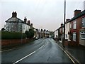
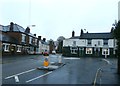
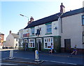
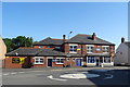
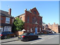
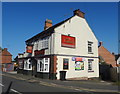
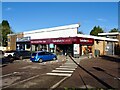
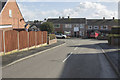
Photos of DE11 0SQ


Area Information
Living in DE11 0SQ means being part of a compact, densely populated residential cluster in South Derbyshire. The area covers just 2.8 hectares, housing 1,740 people in a population density of 61,402 per square kilometre. This small postcode is nestled between Swadlincote to the south and Burton upon Trent to the west, near the A444 and A511 roads. Historically shaped by 18th-century coal and clay industries, the area has evolved into a community with a median age of 47, dominated by adults aged 30–64. Daily life here balances proximity to retail, rail links, and schools with the quietude of a small village. The high broadband score of 100 ensures seamless digital connectivity, while a medium crime risk score of 57 means standard security measures are advisable. Residents benefit from nearby amenities like Sainsburys and Burton railway station, and the area’s compact size fosters a tight-knit community feel. For buyers, DE11 0SQ offers a blend of practicality and historical character, with homes predominantly in private ownership and a focus on family-oriented living.
- Area Type
- Postcode
- Area Size
- 2.8 hectares
- Population
- 1740
- Population Density
- 3452 people/km²
DE11 0SQ is primarily an owner-occupied area, with 71% of properties in private hands. The accommodation type is predominantly houses, reflecting a market skewed towards family homes rather than apartments or flats. This suggests a focus on long-term investment and stability, with limited rental activity. The small area size—just 2.8 hectares—means the housing stock is concentrated, potentially limiting availability for buyers seeking multiple options. The high proportion of owner-occupied homes indicates a community with established residents, which can stabilise property values but may reduce turnover. For buyers, the area’s compact nature means proximity to amenities like schools and transport is a key advantage. However, the limited size of the postcode means those seeking larger properties or more space may need to look beyond immediate surroundings. The predominance of houses also implies a market more suited to buyers prioritising space and privacy over urban convenience.
House Prices in DE11 0SQ
Showing 74 properties
| Address | Type | Beds | Baths | Last Sale Price | Last Sale Date | |
|---|---|---|---|---|---|---|
| 45 Parliament Street, Newhall, Swadlincote, DE11 0SQ | Terraced | 2 | 1 | £137,500 | Nov 2025 | |
| 32 Parliament Street, Newhall, Swadlincote, DE11 0SQ | Semi-detached | 3 | 2 | £140,000 | Apr 2025 | |
| 59 Parliament Street, Newhall, Swadlincote, DE11 0SQ | Semi-detached | 3 | 1 | £138,000 | Nov 2024 | |
| 77 Parliament Street, Newhall, Swadlincote, DE11 0SQ | Semi-detached | 3 | 1 | £124,000 | Feb 2023 | |
| 34 Parliament Street, Newhall, Swadlincote, DE11 0SQ | Semi-detached | 2 | - | £152,000 | Aug 2022 | |
| 81 Parliament Street, Newhall, Swadlincote, DE11 0SQ | Terraced | 5 | 2 | £196,000 | May 2022 | |
| 82 Parliament Street, Newhall, Swadlincote, DE11 0SQ | Detached | 3 | 1 | £170,000 | Mar 2022 | |
| 21 Parliament Street, Newhall, Swadlincote, DE11 0SQ | house | 3 | 1 | £110,000 | Mar 2022 | |
| 44 Parliament Street, Newhall, Swadlincote, DE11 0SQ | Semi-detached | 2 | 1 | £130,000 | Feb 2022 | |
| 13 Parliament Street, Newhall, Swadlincote, DE11 0SQ | Semi-detached | 2 | 1 | £130,000 | Nov 2021 |
Energy Efficiency in DE11 0SQ
Residents of DE11 0SQ enjoy a range of nearby amenities within practical reach. Retail options include Sainsburys Newhall, Sainsburys Swadlincote, and Tesco Swadlincote, providing everyday shopping convenience. The area’s compact size means these stores are accessible without long commutes. For leisure, the village of Newhall features St John’s Anglican Church and Stanton Methodist Church, alongside historical sites like the composite war memorial at Newhall Park. The presence of listed buildings and traditional structures, such as the bottle-shaped kiln in Swadlincote, adds character to daily life. Parks and open spaces, while not explicitly detailed, are implied by the area’s historical references to green spaces. The mix of retail, religious sites, and heritage elements creates a lifestyle that balances practicality with a sense of local identity, ideal for those seeking a small-town feel with modern amenities.
Amenities
Schools
Residents of DE11 0SQ have access to several educational institutions, including Newhall Infant School, a primary school with an Ofsted rating of ‘good’. William Allitt School is another primary option, while the area also hosts specialist facilities like the South Derbyshire Support Centre, Newhall Support Centre, and Esteem South Academy, which cater to additional needs. The mix of primary and support schools suggests a range of educational provision for families, from mainstream schooling to specialist services. For parents, this diversity ensures flexibility depending on children’s requirements. However, the absence of secondary schools within the postcode means students may need to commute to nearby towns like Burton upon Trent or Swadlincote. The quality of local schools, particularly Newhall Infant School’s ‘good’ rating, is a strong selling point for families prioritising education.
| Rank | School | Type | Entry gender | Ages |
|---|
Explore more schools in this area
Go to Schools tabDemographics
DE11 0SQ has a median age of 47, with 71% of residents owning their homes. The population is predominantly adults aged 30–64, reflecting a mature, stable community. Housing is largely composed of detached or semi-detached houses, with 71% of properties in private ownership. The area’s ethnic composition is overwhelmingly White, with no data indicating significant diversity. The high population density—61,402 people per square kilometre—suggests a compact, closely knit settlement, though the small area size of 2.8 hectares means resources and services are concentrated. This demographic profile implies a community focused on long-term residency rather than transient populations. The lack of specific data on deprivation means quality of life is inferred from amenities like schools, transport, and safety assessments. For buyers, the mix of home ownership and family-oriented demographics suggests a market geared towards established households rather than young professionals or renters.
Household Size
Accommodation Type
Tenure
Ethnic Group
Religion
Household Composition
Age
Household Deprivation
NS-SEC
Explore more demographic insights in this area
Go to Demographics tabPlanning
Planning Constraints
- Flood RiskPremium
- Ramsar Wetland SitesPremium
- Area of Outstanding Natural BeautyPremium
- Protected Nature ReservePremium
- Protected WoodlandPremium