Area Overview for DE11 0UG
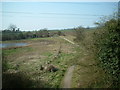
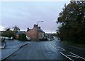
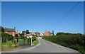
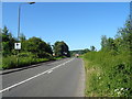
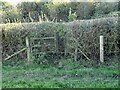
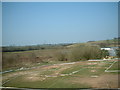
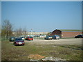
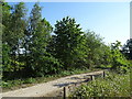
Photos of DE11 0UG


Area Information
Living in DE11 0UG means being part of a tightly knit residential cluster in the heart of Derbyshire’s South East region. This postcode area, covering just 2.0 hectares, is home to 1,642 people, translating to a population density of 343 people per square kilometre. Situated between Swadlincote and Burton upon Trent, it lies near key roads like the A444 and A511, offering easy access to nearby towns. Historically shaped by 18th-century industrial activity, the area retains a quiet, rural character despite its proximity to modern infrastructure. The ward of Newhall and Stanton, which includes this postcode, has a population of around 6,963, according to the 2001 census. Residents benefit from a mix of local amenities, including primary schools, retail outlets, and transport links. The area’s compact size fosters a close-knit community, with daily life centred around local shops, parks, and the historic Newhall Park war memorial. Its strategic location near the M42 motorway and A38 road network ensures connectivity to larger urban centres without sacrificing the charm of a smaller village setting.
- Area Type
- Postcode
- Area Size
- 2.0 hectares
- Population
- 1642
- Population Density
- 343 people/km²
The property market in DE11 0UG is characterised by high home ownership (76%) and a focus on houses as the primary accommodation type. This suggests a market dominated by owner-occupied properties rather than rental units, which may indicate a preference for long-term investment over short-term lettings. The small area size (2.0 hectares) implies a limited number of properties, meaning buyers may need to consider nearby postcode areas for more options. The prevalence of houses, rather than flats or apartments, aligns with the area’s traditional village character and appeal to families. For buyers, this means properties are likely to be larger, with more private outdoor space, though the compact nature of the area could limit availability. The high home ownership rate also suggests a stable market with less pressure from speculative investment, potentially offering better value for those seeking a place to settle long-term.
House Prices in DE11 0UG
Showing 23 properties
| Address | Type | Beds | Baths | Last Sale Price | Last Sale Date | |
|---|---|---|---|---|---|---|
| 13 Woodview Road, Newhall, Swadlincote, DE11 0UG | Terraced | 3 | 1 | £145,000 | Mar 2025 | |
| 1 Woodview Road, Newhall, Swadlincote, DE11 0UG | Bungalow | - | - | £270,000 | Apr 2024 | |
| Sunny View, 25 Woodview Road, Newhall, Swadlincote, DE11 0UG | Semi-detached | 3 | 1 | £217,500 | Jul 2021 | |
| 12 Woodview Road, Newhall, Swadlincote, DE11 0UG | Terraced | 3 | - | £145,000 | Jul 2021 | |
| 6 Woodview Road, Newhall, Swadlincote, DE11 0UG | Detached | 3 | 3 | £235,000 | Dec 2020 | |
| 27 Woodview Road, Newhall, Swadlincote, DE11 0UG | house | - | - | £345,000 | Oct 2020 | |
| 29 Woodview Road, Newhall, Swadlincote, DE11 0UG | house | - | - | £340,000 | Aug 2020 | |
| 11 Woodview Road, Newhall, Swadlincote, DE11 0UG | Terraced | 3 | 2 | £205,000 | Mar 2020 | |
| 17 Woodview Road, Newhall, Swadlincote, DE11 0UG | Semi-detached | 3 | 1 | £175,000 | Oct 2019 | |
| 4 Woodview Road, Newhall, Swadlincote, DE11 0UG | house | - | - | £220,000 | Nov 2017 |
Energy Efficiency in DE11 0UG
The lifestyle in DE11 0UG is defined by convenience and accessibility. Within practical reach are five retail outlets, including Sainsburys Newhall, Tesco Swadlincote, and Aldi Castle, ensuring everyday shopping needs are met without long trips. The area’s proximity to the A444 and A511 roads facilitates easy access to nearby towns for dining, leisure, and cultural activities. Local amenities include parks and historical sites such as St John’s Anglican Church and the composite war memorial in Newhall Park, adding character to daily life. The presence of two railway stations and regular bus services enhances mobility, making it simple to reach larger urban centres. The mix of retail, transport, and green spaces supports a balanced lifestyle, blending rural tranquillity with the practicalities of modern living.
Amenities
Schools
Residents of DE11 0UG have access to three primary schools within practical reach. Newhall Community Junior School and Stanton Primary School both cater to younger children, with the latter holding a ‘good’ Ofsted rating. Newhall Junior School, an academy, provides an alternative educational approach. The mix of traditional primary schools and academies offers families choice in curricula and teaching methods. For parents, the presence of two primary schools within the area reduces the need for long commutes, while the ‘good’ rating at Stanton Primary School signals a reliable standard of education. The absence of secondary schools in the immediate vicinity means students may need to travel to nearby towns like Swadlincote or Burton upon Trent, but the proximity of these towns via road and rail networks mitigates this challenge. The school options reflect a balance between local convenience and access to broader educational resources.
| Rank | School | Type | Entry gender | Ages |
|---|
Explore more schools in this area
Go to Schools tabDemographics
The population of DE11 0UG skews towards adults aged 30–64, with a median age of 47. This suggests a stable community with a strong presence of working-age residents and families. Home ownership is high, at 76%, indicating a preference for long-term residency over rental properties. The accommodation type is predominantly houses, reflecting a traditional, family-oriented housing stock. The predominant ethnic group is White, with no specific data provided on other demographics. The age profile and home ownership figures suggest a mature, established community with lower turnover. The absence of data on deprivation levels means the area’s quality of life cannot be assessed in that context, but the high home ownership and stable age range imply a relatively affluent and settled population. This demographic profile may appeal to buyers seeking a stable, low-maintenance environment with minimal rental market activity.
Household Size
Accommodation Type
Tenure
Ethnic Group
Religion
Household Composition
Age
Household Deprivation
NS-SEC
Explore more demographic insights in this area
Go to Demographics tabPlanning
Planning Constraints
- Flood RiskPremium
- Ramsar Wetland SitesPremium
- Area of Outstanding Natural BeautyPremium
- Protected Nature ReservePremium
- Protected WoodlandPremium