Area Overview for DE11 0TA
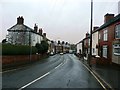
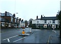
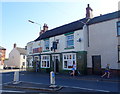
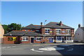
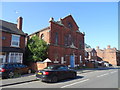
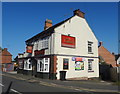
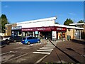
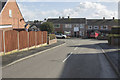
Photos of DE11 0TA


Area Information
Living in DE11 0TA means being part of a small, tightly knit residential cluster in the heart of Derbyshire. The area covers 4,570 square metres and is home to 1,642 people, with a population density of 343 people per square kilometre. Situated between Swadlincote and Burton upon Trent, it lies near the A444 and A511 roads, offering easy access to nearby towns. Historically shaped by 18th-century industrial activity, the area retains a rural character despite its proximity to modern infrastructure. Newhall and Stanton, the villages within this postcode, are connected to major routes like the M42 and A38, facilitating travel to Nottingham, Birmingham, and Derby. The community benefits from a blend of traditional architecture and contemporary amenities, with local landmarks such as St John’s Anglican Church and Newhall Park’s war memorial adding to its heritage. Daily life here balances quiet residential living with practical connectivity, making it appealing for those seeking a stable, low-density environment without sacrificing access to services.
- Area Type
- Postcode
- Area Size
- 4570 m²
- Population
- 1642
- Population Density
- 343 people/km²
DE11 0TA is primarily an owner-occupied area, with 76% of properties in private hands. The housing stock is dominated by individual houses, reflecting the character of a small rural community rather than high-density development. This makes the area attractive to buyers seeking family homes with space and a sense of permanence. The limited size of the postcode—just 4,570 square metres—means the property market is compact, with limited scope for new builds or rental properties. Buyers should consider that the area’s small footprint may restrict availability, particularly for those seeking investment opportunities. The prevalence of owner-occupied homes also suggests a low turnover of properties, which could influence pricing dynamics. For those prioritising a quiet, established neighbourhood over urban convenience, DE11 0TA offers a stable, low-risk option with strong community ties.
House Prices in DE11 0TA
Showing 11 properties
| Address | Type | Beds | Baths | Last Sale Price | Last Sale Date | |
|---|---|---|---|---|---|---|
| 8 Brailsford Avenue, Newhall, Swadlincote, DE11 0TA | Semi-detached | 3 | 1 | £200,000 | Nov 2022 | |
| 7 Brailsford Avenue, Newhall, Swadlincote, DE11 0TA | Semi-detached | 3 | 1 | £162,000 | Jan 2020 | |
| 5 Brailsford Avenue, Newhall, Swadlincote, DE11 0TA | Semi-detached | 3 | 1 | £158,000 | Oct 2019 | |
| 2 Brailsford Avenue, Newhall, Swadlincote, DE11 0TA | Semi-detached | 3 | 1 | £114,000 | Nov 2014 | |
| 9 Brailsford Avenue, Newhall, Swadlincote, DE11 0TA | Detached | - | - | £68,000 | Oct 2000 | |
| 10 Brailsford Avenue, Newhall, Swadlincote, DE11 0TA | Detached | 3 | 2 | - | - | |
| 1 Brailsford Avenue, Newhall, Swadlincote, DE11 0TA | Semi-detached | - | - | - | - | |
| 4 Brailsford Avenue, Newhall, Swadlincote, DE11 0TA | Semi-detached | - | - | - | - | |
| 12 Brailsford Avenue, Newhall, Swadlincote, DE11 0TA | Detached | 3 | 1 | - | - | |
| 3 Brailsford Avenue, Newhall, Swadlincote, DE11 0TA | Semi-detached | - | - | - | - |
Energy Efficiency in DE11 0TA
Daily life in DE11 0TA is shaped by a mix of local shops, historical sites, and community spaces. Nearby retail options include Sainsburys Newhall, Tesco Swadlincote, and Sainsburys Swadlincote, providing essential groceries and services within a short drive. The area’s proximity to Burton upon Trent and Swadlincote adds access to larger retail and dining choices. Recreational opportunities include St John’s Anglican Church, Stanton Methodist Church, and Newhall Park’s war memorial, which contribute to the area’s cultural and historical identity. The small size of the postcode means amenities are concentrated, reducing the need for long commutes. This balance of practicality and character makes DE11 0TA ideal for those who value convenience without sacrificing a sense of place.
Amenities
Schools
Residents of DE11 0TA have access to a range of primary and academy schools. Newhall Community Junior School provides primary education, while Stanton Primary School, rated ‘good’ by Ofsted, offers a similarly structured curriculum. Newhall Junior School, an academy, adds diversity to the educational landscape. The presence of both state-funded and academy schools ensures families can choose between traditional and alternative teaching models. For parents, this mix provides flexibility, particularly for those seeking schools with distinct pedagogical approaches. The proximity of these institutions to residential areas means children can access education without long commutes. However, the absence of secondary schools in the immediate vicinity may require families to look to nearby towns like Swadlincote or Burton upon Trent for senior education. Overall, the school options reflect a community prioritising accessible, quality education for younger children.
| Rank | School | Type | Entry gender | Ages |
|---|
Explore more schools in this area
Go to Schools tabDemographics
The demographic profile of DE11 0TA reflects a mature, settled community. The median age is 47, with the majority of residents falling within the 30–64 age range, indicating a strong presence of working-age adults and families. Home ownership is high at 76%, suggesting a stable, long-term resident base. The area is predominantly composed of houses, aligning with the typical housing stock of small rural clusters. The predominant ethnic group is White, with no specific data on other demographics provided. This age profile and ownership rate imply a community focused on family living and long-term investment. The population density of 343 per square kilometre is moderate, ensuring a balance between residential space and communal access to amenities. The absence of detailed diversity data means the area’s social fabric is likely homogenous, though this does not detract from its appeal for those prioritising stability and a familiar environment.
Household Size
Accommodation Type
Tenure
Ethnic Group
Religion
Household Composition
Age
Household Deprivation
NS-SEC
Explore more demographic insights in this area
Go to Demographics tabPlanning
Planning Constraints
- Flood RiskPremium
- Ramsar Wetland SitesPremium
- Area of Outstanding Natural BeautyPremium
- Protected Nature ReservePremium
- Protected WoodlandPremium