Area Overview for CV13 0QQ
Photos of CV13 0QQ
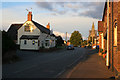
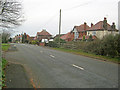
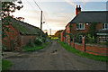
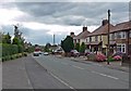
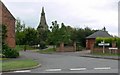
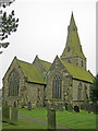
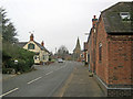
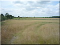
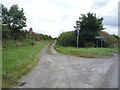
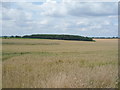
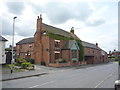
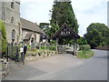
35 photos from this area
Area Information
Key information about the CV13 0QQ including its size, population, and administrative classification.
- Area Type
- Postcode
- Area Size
- 17.2 hectares
- Population
- 1682
- Population Density
- 116 people/km²
House Prices in CV13 0QQ
11
Properties
£411,286
Average Sold Price
£120,000
Lowest Price
£767,500
Highest Price
Showing 11 properties
| Address | Type | Beds | Baths | Last Sale Price | Last Sale Date | |
|---|---|---|---|---|---|---|
| 12 Rectory Lane, Nailstone, CV13 0QQ | Detached | 4 | 2 | £480,000 | Sep 2017 | |
| 16 Rectory Lane, Nailstone, CV13 0QQ | house | 5 | - | £393,000 | Nov 2012 | |
| 6 Rectory Lane, Nailstone, CV13 0QQ | Detached | 4 | - | £400,000 | Sep 2012 | |
| Epsom House, 15 Rectory Lane, Nailstone, CV13 0QQ | house | 6 | - | £767,500 | Aug 2011 | |
| Glebe Farm, 1 Rectory Lane, Nailstone, CV13 0QQ | Semi-detached | - | - | £450,000 | Nov 2005 | |
| The Briars, 10 Rectory Lane, Nailstone, CV13 0QQ | Detached | - | - | £268,500 | Mar 2000 | |
| 14 Rectory Lane, Nailstone, CV13 0QQ | Detached | - | - | £120,000 | May 1997 | |
| Ascot House, Rectory Lane, Nailstone, CV13 0QQ | Detached | 6 | - | - | - | |
| Stonehaven, 8 Rectory Lane, Nailstone, CV13 0QQ | Bungalow | - | - | - | - | |
| Old Rectory, 11 Rectory Lane, Nailstone, CV13 0QQ | Detached | - | - | - | - |
Page 1 of 2
Energy Efficiency in CV13 0QQ
Amenities
Schools
| Rank | School | Type | Entry gender | Ages |
|---|
Explore more schools in this area
Go to Schools tabDemographics
Household Size
Two person
most common
Accommodation Type
Houses
most common
Tenure
69
majority
Ethnic Group
White
most common
Religion
N/A
most common
Household Composition
N/A
most common
Age
47
median
Adults (30-64 years)
most common
Household Deprivation
N/A
with no deprivation
NS-SEC
32
in Lower managerial occupations
Explore more demographic insights in this area
Go to Demographics tabPlanning
Planning Constraints
- Flood RiskPremium
- Ramsar Wetland SitesPremium
- Area of Outstanding Natural BeautyPremium
- Protected Nature ReservePremium
- Protected WoodlandPremium