Area Overview for CV13 0QJ
Photos of CV13 0QJ
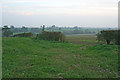
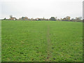
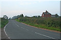
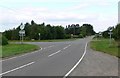
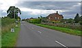
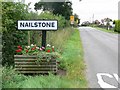

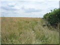
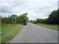
26 photos from this area
Area Information
Key information about the CV13 0QJ including its size, population, and administrative classification.
- Area Type
- Postcode
- Area Size
- 45.3 hectares
- Population
- 1682
- Population Density
- 116 people/km²
House Prices in CV13 0QJ
45
Properties
£271,800
Average Sold Price
£60,000
Lowest Price
£435,000
Highest Price
Showing 45 properties
| Address | Type | Beds | Baths | Last Sale Price | Last Sale Date | |
|---|---|---|---|---|---|---|
| 2 Bagworth Road, Nailstone, CV13 0QJ | house | 3 | 1 | £121,000 | Jan 2025 | |
| 65 Bagworth Road, Nailstone, CV13 0QJ | Detached | 3 | 2 | £420,000 | Aug 2023 | |
| 83 Bagworth Road, Nailstone, CV13 0QJ | Bungalow | - | - | £392,000 | Aug 2022 | |
| 21 Bagworth Road, Nailstone, CV13 0QJ | Semi-detached | 3 | 2 | £290,000 | Sep 2021 | |
| 1 Bagworth Road, Nailstone, CV13 0QJ | Semi-detached | 2 | 1 | £180,000 | Jul 2021 | |
| 31 Bagworth Road, Nailstone, CV13 0QJ | Bungalow | - | - | £272,500 | Apr 2021 | |
| 9 Bagworth Road, Nailstone, CV13 0QJ | Semi-detached | 4 | 3 | £285,000 | Mar 2021 | |
| 67 Bagworth Road, Nailstone, CV13 0QJ | house | - | - | £347,500 | Jan 2021 | |
| 57 Bagworth Road, Nailstone, CV13 0QJ | Detached | 4 | 2 | £330,000 | Aug 2020 | |
| 41 Bagworth Road, Nailstone, CV13 0QJ | Detached | 3 | 1 | £285,000 | May 2020 |
Page 1 of 5
Energy Efficiency in CV13 0QJ
Amenities
Schools
| Rank | School | Type | Entry gender | Ages |
|---|
Explore more schools in this area
Go to Schools tabDemographics
Household Size
Two person
most common
Accommodation Type
Houses
most common
Tenure
69
majority
Ethnic Group
White
most common
Religion
N/A
most common
Household Composition
N/A
most common
Age
47
median
Adults (30-64 years)
most common
Household Deprivation
N/A
with no deprivation
NS-SEC
32
in Lower managerial occupations
Explore more demographic insights in this area
Go to Demographics tabPlanning
Planning Constraints
- Flood RiskPremium
- Ramsar Wetland SitesPremium
- Area of Outstanding Natural BeautyPremium
- Protected Nature ReservePremium
- Protected WoodlandPremium