Area Overview for Esclusham Community
Photos of Esclusham Community
Area Information
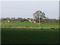
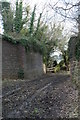
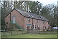
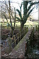
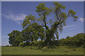
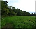
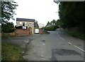
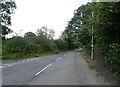
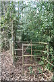
Esclusham Community is a civil parish located within Wrexham County Borough in north-east Wales. You are looking at a territory covering 16.6 square kilometres that combines distinct rural and semi-urban elements. The area encompasses the relatively urbanised eastern village of Rhostyllen, which sits near the suburbs of Wrexham, contrasting sharply with the rural western part that rises to moorland on Esclusham Mountain. This diversity defines daily life, offering both village convenience and access to open high pastureland. The community includes significant green spaces such as the land above Fron-deg and Aber-oer. Historically, the name dates back to 1315 and derives from Old English roots meaning settlement. The local Parish Hall in Rhostyllen currently serves as the central community base. You are moving into an area with a small population of 1,476 residents. This figure represents the current census data, though historical records show the population fluctuated significantly in the early 2000s. Living in Esclusham Community means navigating a landscape that ranges from the settled streets of Rhostyllen to the moorland terrain of Esclusham Mountain. The area retains its identity as a distinct electoral ward with a long history dating to the Marcher Lordship of Bromfield and Yale. Your daily routines will involve moving between these two contrasting environments, enjoying the proximity to established services while surrounded by natural features. This layout provides a specific character different from larger urban centres, focusing on a mix of residential living and open countryside.
- Area Type
- Parish
- Area Size
- 16.6 km²
- Population
- 1476
- Population Density
- 89 people/km²
Demographics
The people living in Esclusham Community fit a specific demographic profile characterised by an older population. The median age stands at 70 years, indicating that seniors make up a significant portion of the resident base. Age data confirms that the total age range reflects this mature community structure. Home ownership is a dominant feature of the local resident experience, with 73% of households owning their property. This high ownership rate suggests stability and long-term settlement within the parish boundaries. You will find that the household composition and accommodation types align with this owner-occupied trend. The ethnic diversity within the area follows national patterns, although specific breakdowns are not detailed in current summaries. Religious affiliation similarly adheres to broader regional trends without specific local percentages available. The 73% homeownership figure is the most definitive statistic regarding who owns homes in Esclusham Community. This climate means you are unlikely to encounter a purely rental market in your immediate surroundings. The demographics paint a picture of established families and retirees rather than transient populations. Your neighbours are likely to be permanent residents who have invested deeply in the local area over decades. This demographic reality influences the pace of life and the nature of community interactions. Understanding that the median age is 70 helps you anticipate the social environment and potential services required by residents.
Household Size
Accommodation Type
Tenure
Ethnic Group
Religion
Household Composition
Age
Household Deprivation
NS-SEC
Explore more demographic insights in this area
Go to Demographics tabPlanning
Planning Constraints
- Flood RiskPremium
- Ramsar Wetland SitesPremium
- Area of Outstanding Natural BeautyPremium
- Protected Nature ReservePremium
- Protected WoodlandPremium
- Crime RiskPremium