Area Overview for Llangollen Rural Community
Photos of Llangollen Rural Community
Area Information
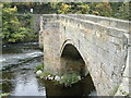
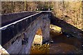
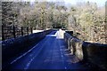
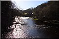
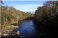
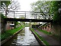
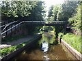
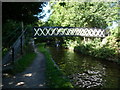
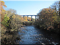
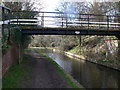
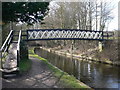
Living in Llangollen Rural Community offers a distinct experience within the wider Welsh landscape. This civil parish covers an area of 5.3 km², providing a compact yet defined space for residents. The location sits within a specific heritage and environmental context, characterising daily life here. You are living in an area where the physical boundaries are clear and the surroundings are protected. The identity of the parish is rooted in its rural nature. Every resident navigates an environment where planning constraints play a significant role in development. For those seeking homes in Llangollen Rural Community, the scale of the locality ensures you are surrounded by established character. The area is not sprawling, which fosters a sense of local familiarity. You study maps to understand the layout, knowing the total footprint is small enough to traverse easily on foot or by car. This concentration of land creates a neighbourhood where passing residents know each other. The designation as an Area of Outstanding Natural Beauty means the visual landscape remains intact. While you enjoy the scenery, you also accept the restrictions that come with such a protected status. Your home sits within a framework designed to preserve the natural environment. This balance defines what it means to live here, distinguishing it from urban or suburban settings across the UK.
- Area Type
- Parish
- Area Size
- 5.3 km²
- Population
- Not available
- Population Density
- Not available
Demographics
The people forming the community of Llangollen Rural Community reflect a settled, older population. The median age stands at 70, indicating that the average resident is well into pensionable age. This contrasts sharply with many urban areas where younger families might dominate the demographic profile. Most people in this parish belong to the total age category, suggesting a broad spread or a lack of specific younger cohorts. About 76% of all households own their property outright or with a mortgage. This high rate of ownership suggests deep roots in the locality rather than a transient population of tenants. The household composition data records total figures without breaking down family structures, meaning you must rely on the age statistics to infer lifestyle. Accommodation types are similarly summarised as a total, precluding specific counts of detached versus terraced homes. Ethnic diversity and religious affiliation are recorded as total entries, offering no granular breakdown of the community's cultural mix. You will likely find an older, predominantly white demographic given the typical profile of such rural parishes in Wales. There are no recorded statistics on deprivation levels to explain quality of life pressures, so you must judge the area based on age and property tenure alone. The outlook is one of stability and established residency rather than rapid change.
Household Size
Accommodation Type
Tenure
Ethnic Group
Religion
Household Composition
Age
Household Deprivation
NS-SEC
Explore more demographic insights in this area
Go to Demographics tabPlanning
Planning Constraints
- Flood RiskPremium
- Ramsar Wetland SitesPremium
- Area of Outstanding Natural BeautyPremium
- Protected Nature ReservePremium
- Protected WoodlandPremium
- Crime RiskPremium