Area Overview for Gwersyllt Community
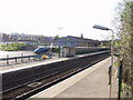
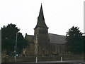
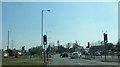
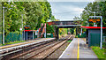
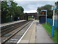
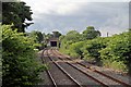
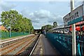
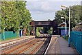
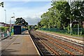
Photos of Gwersyllt Community


Area Information
Living in Gwersyllt Community offers a defined sense of place within the County Borough of Wrexham. This civil parish covers an area of 8.1 km² and currently supports a population of 2,676 people. The location spans specific localities including Summerhill, Bradley, Rhosrobin, Moss, Parkwall, and Sydallt. For those considering homes in Gwersyllt Community, the area provides a distinct residential environment that evolved from its origins as a township of Gresford parish by 1833. Historical development was driven by coal mining collieries, such as the Gwersyllt colliery which employed 185 staff by 1896, and subsequent planned council estates from the mid-20th century. Today, the community is subdivided into Gwersyllt North, West, East, and South for local government functions. The name itself likely derives from the Welsh word *gwersyll*, meaning campsite, or an earlier English form like Wershull. Residents enjoy proximity to key landmarks, including Holy Trinity Church, consecrated in 1851, and the Gwersyllt Congregational Church, established in 1809. While the area has a rich industrial past, modern residents experience a settled neighbourhood where you can walk past the Grade II listed war memorial at Wheatsheaf Lane or visit the Aurelius Window within the church. Understanding the scale of Gwersyllt Community as a small yet distinct parish helps frame expectations for life here, blending historical character with established residential infrastructure.
- Area Type
- Parish
- Area Size
- 8.1 km²
- Population
- 2676
- Population Density
- 328 people/km²
Demographics
The demographic profile of Gwersyllt Community reveals a community dominated by older residents. The median age stands at 70 years, a figure significantly higher than the national average. This indicates that the most common age group within the parish consists of older adults. You are unlikely to find a highly youthful population driving the local scene, instead finding a neighbourhood settled by long-term residents. Regarding housing tenure, home ownership levels are robust, with 67% of households owning their property outright or with a mortgage. This high rate of ownership suggests a stable, settled population rather than a transient rental market. The remaining 33% of households consist of renters or those living in social housing. Detailed breakdowns regarding household composition, accommodation types, predominant ethnic groups, and religious affiliations are not specified in the available records, but the high ownership figure provides a clear picture of the community's stability. For someone considering living in Gwersyllt Community, the environment is tailored towards those seeking a quiet, owner-occupied setting. The area does not appear to be focused on student accommodation or corporate rentals. The lack of data on specific ethnic or religious breakdowns means a detailed sociological portrait is unavailable, yet the dominant age and ownership metrics clearly define the social fabric. You can expect a neighbourhood where families and seniors typically reside in self-owned homes, creating a consistent and predictable living environment.
Household Size
Accommodation Type
Tenure
Ethnic Group
Religion
Household Composition
Age
Household Deprivation
NS-SEC
Explore more demographic insights in this area
Go to Demographics tabPlanning
Planning Constraints
- Flood RiskPremium
- Ramsar Wetland SitesPremium
- Area of Outstanding Natural BeautyPremium
- Protected Nature ReservePremium
- Protected WoodlandPremium
- Crime RiskPremium