Area Overview for Gresford Community
Photos of Gresford Community

Area Information
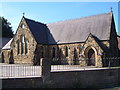
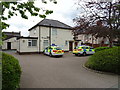
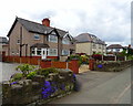
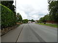
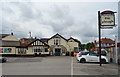
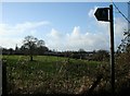
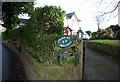
Gresford Community is a civil parish situated in Wrexham County Borough, north-east Wales. This historic settlement occupies 8.8 km² and lies approximately 3 miles north-east of Wrexham town centre. The area sits near the Alyn river valley, a location defined by its origins. Records show the village appeared as Gretford in the Domesday Book of 1086. Early development included a manor, a church, and a priest. The name itself references a grass ford used for crossing the river. Residential life here has deep roots, evolving from a farming community to one shaped by industrial demands. The village sits close to the industrial heritage of coal mining, yet today operates as a quiet residential parish. You live in an area where the physical landscape retains strong historical markers. The settlement includes All Saints Church, built of distinctive Cefn stone. Modern planning also navigates local environmental protections. Residents benefit from a compact layout that connects to surrounding landscapes. Living in Gresford Community means accessing a nuanced balance between rural tranquillity and proximity to urban amenities. The parish offers a specific character defined by its 11th-century origins and thorough association with the local coal industry legacy.
- Area Type
- Parish
- Area Size
- 8.8 km²
- Population
- Not available
- Population Density
- Not available
Demographics
The population within Gresford Community skews significantly older than the national average. Data indicates a median age of 70 years. This figure suggests the village is populated largely by retirees or older long-term residents. The breakdown shows the Age group is the primary demographic category. Home ownership stands at an exceptional 85% of dwellings. This high rate implies very few residents rent properties. Most people who live here have purchased their homes outright or have significant equity. The household composition total reflects this stable ownership base. There is no indication of a rented or student-led population. Diversity metrics are recorded as total, offering no specific breakdown for predominant ethnic groups in the available dataset. Religious affiliation is similarly noted as total without further detail. You can expect a community where the majority of homes in Gresford Community are family-owned or owned by older individuals. There are no private rental estates dominating the streets. The character of the parish is defined by long-term residents rather than transient populations. Seniors and empty nesters likely comprise the bulk of neighbours you might meet.
Household Size
Accommodation Type
Tenure
Ethnic Group
Religion
Household Composition
Age
Household Deprivation
NS-SEC
Explore more demographic insights in this area
Go to Demographics tabPlanning
Planning Constraints
- Flood RiskPremium
- Ramsar Wetland SitesPremium
- Area of Outstanding Natural BeautyPremium
- Protected Nature ReservePremium
- Protected WoodlandPremium
- Crime RiskPremium