Area Overview for Wick Community
Photos of Wick Community


Area Information
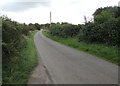
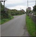
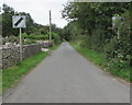
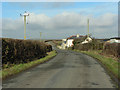
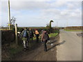
Wick Community is a civil parish located in Wales covering an area of 7.3 km². Living in this parish offers a settled environment where the scale of the locality supports a close-knit atmosphere. The area provides a distinct backdrop for residents who prefer a specific geographical setting without the density of major urban centres. Daily life here involves navigating a defined space where local rituals often centre on community engagement rather than high-street activity. You will find that the environment is structured by its size, which limits expansion but preserves a sense of local identity. This status as a civil parish defines the administrative boundaries and governance that affect local decision-making. Prospective buyers looking for homes in Wick Community enter a market shaped by these specific constraints. The area presents a clear picture of what regular life involves in this Welsh location. You can expect a routine that is grounded in the practicalities of a defined parish area. The character of the community reflects its administrative history and the choices made by those who have settled there over time.
- Area Type
- Parish
- Area Size
- 7.3 km²
- Population
- Not available
- Population Density
- Not available
Demographics
The community profile in Wick Community reveals a population with a median age of 70 years. This figure indicates a significant concentration of older residents within the parish boundaries. Living in Wick Community means you are likely to encounter a demographic where life experience dominates the social fabric. Almost 84% of households own their homes, suggesting a stable population with deep local roots. This high rate of home ownership points to an area where long-term residency is the norm rather than the exception. The data does not specify the predominant ethnic group, religion, or most common age range breakdown beyond the median age provided. Consequently, understanding the full cultural and religious diversity requires looking beyond the explicit population statistics. You should expect a community where the age of the population is the most defining statistical characteristic. Deprivation data is not available for this specific parish in the current information set. Therefore, assessments of the quality of life must rely on the observable metrics of age and ownership. The household composition and accommodation types are recorded but lack detailed breakdowns in the provided figures.
Household Size
Accommodation Type
Tenure
Ethnic Group
Religion
Household Composition
Age
Household Deprivation
NS-SEC
Explore more demographic insights in this area
Go to Demographics tabPlanning
Planning Constraints
- Flood RiskPremium
- Ramsar Wetland SitesPremium
- Area of Outstanding Natural BeautyPremium
- Protected Nature ReservePremium
- Protected WoodlandPremium
- Crime RiskPremium