Area Overview for Penllyn Community
Photos of Penllyn Community
Area Information
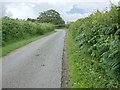
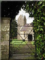
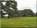
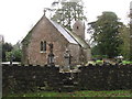
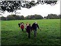
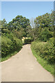
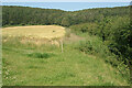
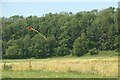
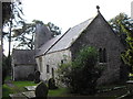
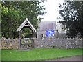
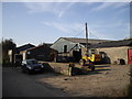
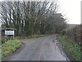
Living in Penllyn Community offers a distinct character within the Vale of Glamorgan, situated north-west of the town of Cowbridge. This civil parish covers an area of 20.7 km², providing a compact yet substantial neighbourhood for residents. You are centrally located among historic landmarks, including Penllyn Castle, also known as Great House, and a mid-Victorian water tower. The history here is deep, with the manor occupied continuously since the 11th century by notable families. The second largest Norman motte in Glamorgan stands as a key feature, adding to the area's unique landscape. Daily life involves navigating farm buildings at Llansannor Court Farm and lime kilns at Pant-y-Lliwydd Farm. The village feels rooted in its past, having served as a Red Cross Hospital during the First World War before passing through various ownerships. There is an A186 road connection nearby, facilitating travel to Cowbridge. Penllyn remains a place where you can walk past agricultural houses and historic halls like Ystradowen Ash Hall. The narrow streets and density suggest a community focused on local landmarks rather than wide, modern boulevards. You will find a mix of C17-C19 farm structures and modern necessities like a water tower. The area blends historical significance with practical rural living, making it a settled environment where history and geography intersect.
- Area Type
- Parish
- Area Size
- 20.7 km²
- Population
- Not available
- Population Density
- Not available
Demographics
The community profile of Penllyn Community reflects a settled, mature population. The median age is recorded at 70 years, indicating that the majority of residents are retirees. The data lists the most common age range as "Age: Total", suggesting a broad distribution but heavily weighted toward older demographics. Home ownership is exceptionally high at 88 per cent, which shapes the local social dynamics. This high level of ownership means you are likely to find long-term residents who have built their lives within the parish boundaries. There is very little renter turnover, creating a stable environment where neighbours have known each other for generations. The household composition data is listed as "total", meaning specific breakdowns are not detailed in the available records, but the high ownership rate implies mostly single-person or couple households. Accommodation types are listed as "total", indicating a variety of structures ranging from the C18 cottage stock to potentially converted farm offices. The predominant ethnic group and religious affiliation are listed as "total", reflecting a generally secular or broadly inclusive community typical of rural Wales. You should expect a quiet, traditional lifestyle where the typical household consists of an older person or retired couple managing their own home.
Household Size
Accommodation Type
Tenure
Ethnic Group
Religion
Household Composition
Age
Household Deprivation
NS-SEC
Explore more demographic insights in this area
Go to Demographics tabPlanning
Planning Constraints
- Flood RiskPremium
- Ramsar Wetland SitesPremium
- Area of Outstanding Natural BeautyPremium
- Protected Nature ReservePremium
- Protected WoodlandPremium
- Crime RiskPremium